STP 09-11-2015: Toasty And Dry Thursday

Issue Date: 9/11/2015
Issue Time: 9:10AM

Summary:

Summer was definitely hanging on over Colorado on Thursday, with high temperatures in the mid-80s to mid-90s in lower elevation locations. Low precipitable water values and a lack of instability prevented rainfall across the state.

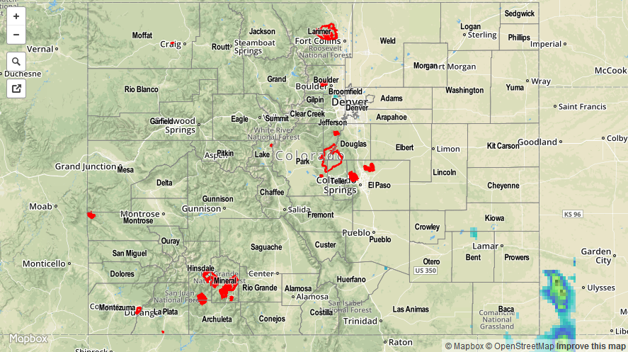
With summer coming to an end, it is interesting to note how quiet the wildfire season has been. Wildfire activity is quiet common during July and August over higher terrain of Colorado. However, this season, the persistent early summer rains caused a strong build up in soil moisture, which is a strong suppressant of fire activity. The same thing cannot be said for the Pacific Northwest where very dry soils, consistently warm temperatures and gusty winds have fueled near record wildfire activity.

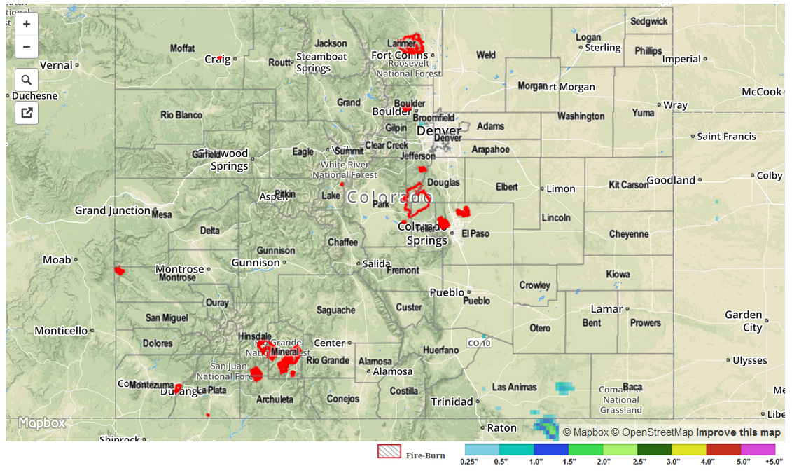
Flooding was not reported yesterday. For estimated rainfall in your area, check out radar-estimated map below.

09112015_STPImage
Storm Total Precip Legend

STP 09-10-2015: Hard to Beat Yesterday’s Weather

Issue Date: Thursday, September 10th, 2015
Issue Time: 9:00 AM MDT

Summary:

Dry air ushered in beautiful weather yesterday as temperatures climbed to, or just above, seasonal averages underneath sunny skies. The subsident airmass suppressed the small chances of showers/weak thunderstorms, leaving everyone with a beautiful, late-summer day. When Mother Nature provides a day like yesterday, there is not much to report in the STP discussion.

No flash flooding was reported yesterday.

STP_snapshot_20150910

STP 09-09-2015: A Beautiful Day Overall

Issue Date: Wednesday, September 9th, 2015
Issue Time: 9:00 AM MDT

Summary:

A shortwave trough moved across the state yesterday in quick fashion, ushering in drier air and pleasant conditions. A few showers were able to develop across the higher terrain and Southeast Plains, generally resulting in light rain and gusty winds. All precipitation totals were less than 0.25 inches, with most coming in less than 0.1 inches. Temperatures climbed to seasonal levels, making for a great, early September day.

No flash flooding was reported yesterday. For a look at yesterday’s rainfall totals, be sure and check out the STP map below.

09092015_STPImage
Storm Total Precip Legend

STP 09-08-2015: Cool Front, Upper-Level Support, and Moderate Moisture Sparked Scattered Showers/Thunderstorms

Issue Date: Tuesday, September 8th, 2015
Issue Time: 9:00 AM MDT

Summary:

Overall, Labor Day turned out to be a fairly pleasant day regarding temperature, even if isolated-to-scattered showers and thunderstorms brought a bit of rain. Precipitable water values hovered around average for this time of year, and showers/thunderstorms responded by producing average rain rates, nowhere near enough to cause flash flooding issues. Most of the activity stayed above and adjacent to the High Country, with isolated-to-widely scattered thunderstorms present over the eastern plains. CoCoRaHS observations, where available, show that rainfall stayed below 0.5 inches, with most in the 0.05-0.20 inch range. Counties with reports of greater than 0.25 inches are:

Eagle County: 0.38 inches
Larimer County: 0.26 inches
Summit County: 0.26 inches

No flash flooding was reported yesterday. Please be sure and check the STP map below for a statewide look at yesterday’s rainfall.

09082015_STPImage
Storm Total Precip Legend