STP 09-15-2015: Western Moisture Transport Increased, Bringing Light-to-Moderate Rainfall to the High Country

Issue Date: Tuesday, September 15th, 2015
Issue Time: 9:00 AM MDT

Summary:

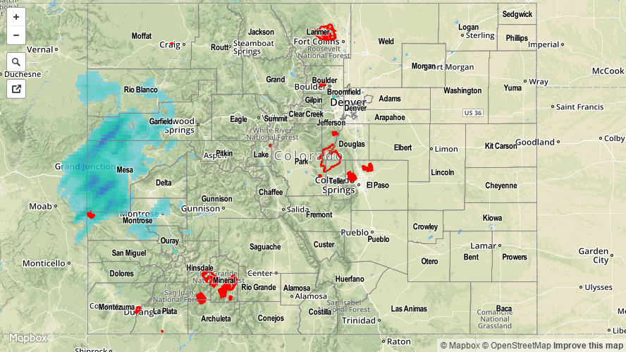
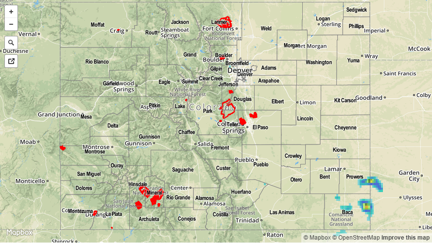
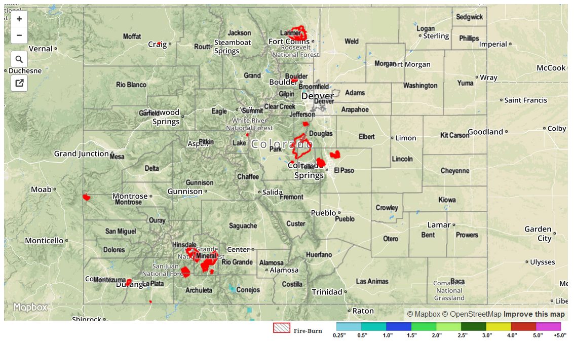
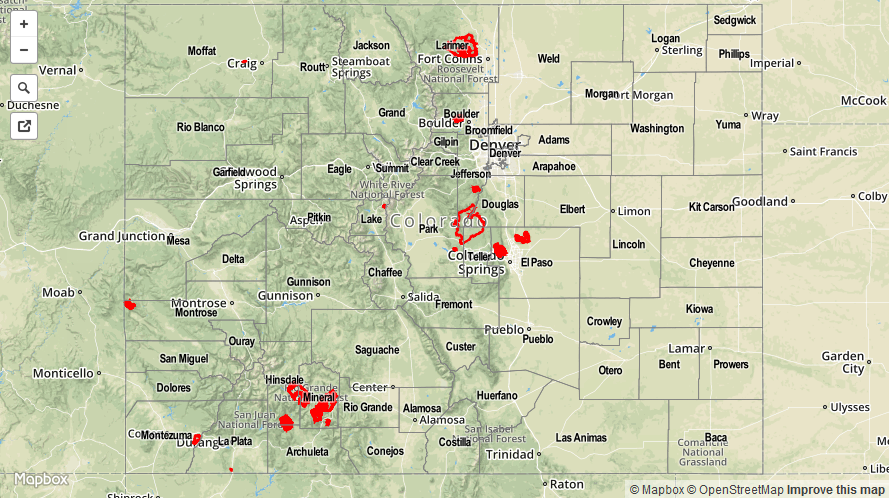
A large-scale trough entered the west coast of North America yesterday, increasing moisture across Colorado. The moisture transport came from the west, rather than the southwest, signaling that the monsoon is waning quickly. Favorable dynamics associated with the trough brought widespread light-to-moderate rainfall across the High Country yesterday, mainly along and west of the Continental Divide. Low-level dry air kept heavy rain out of the forecast, so no flash flooding was observed. From CoCoRaHS observers, the following counties were the “big winners” regarding rainfall reports:

Gunnison County: 0.65 inches
Mesa County: 0.48 inches
Garfield County: 0.36 inches
Moffat County: 0.28 inches
Montrose and Delta County: 0.26 inches
Eagle County: 0.25 inches

Please be sure and check the STP map below for a statewide look at yesterday’s precipitation.

20150915_STPImage
Storm Total Precip Legend

STP 09-14-2015: Hot, Mostly Dry, and 1 Hail Storm

Issue Date: 9/14/2015
Issue Time: 9:10AM

Summary:

Hot and very dry weather continued across most of Colorado on Sunday. Temperatures started out cool, but by early afternoon, quickly warmed to be about 7-15F above normal for this time of year. The town of Wray, close to the Kansas and Nebraska borders, reported a temperature of 100F during the mid-afternoon hours. Many other lower-elevation locations saw temperatures in the mid-90s.

Meanwhile, a few thunderstorms formed in extreme southeastern Colorado (Prowers and Baca counties) shortly after 4PM. While the radar estimated map, below, suggests very heavy rainfall, it is highly unlikely that those estimates were observed at the surface. First of all, the sub-cloud air was extremely dry with relative humidity values in the 20-30% range. Second, ¾ inch hail was reported with the storms, which suggests that hail contamination likely caused overestimates by the radar beam. Third, Prowers and Baca counties are located quite far from any National Weather Service radar sites. This implies that the estimates in the map below were sampling the storms at very high altitudes, where conditions were significantly different than what was observed at the surface. In all, the highest CoCoRaHS official report was only 0.10 inches. Heavier rainfall likely occurred between rain gauges, but nowhere close to the estimates below.

Flooding was not reported yesterday. For estimated rainfall in your area, check out radar-estimated map below (please read the paragraphs above for caveats about these estimates).

20150914_STPImage
Storm Total Precip Legend

STP 09-13-2015: Saturday Lived Up to Expectations

Issue Date: Sunday, September 13th, 2015
Issue Time: 9:00 AM MDT

Summary:

It is hard to argue with the weather provided to Colorado yesterday, as it turned out to be a beautiful mid-September day. High temperatures climbed to near, or just above, seasonal averages thanks to abundant sunshine and dry conditions. With clear skies overnight, radiational cooling allowed for a fairly significant diurnal swing in temperatures, dropping nighttime temperatures into the “comfortably cool” category.

No flash flooding was reported yesterday.

STP_snapshot_20150914

STP 09-12-2015: Frontal Passage brought Cooler Temperatures to Eastern Colorado

Issue Date: Saturday, September 12th, 2015
Issue Time: 9:00 AM MDT

Summary:

A reasonably strong cool front made its way through eastern Colorado, dropping high temperatures 10-15 degrees from the previous day. Surface high pressure awaited behind the front, and subsidence aloft combined to create an environment hostile to any potential showers. Upslope flow helped to bring an increase in clouds, especially south of Highway 24, but there just wasn’t enough moisture for upslope flow to produce any precipitation. West of the Continental Divide, temperatures were nearly the same as the previous day’s highs underneath mostly sunny skies.

No flash flooding was reported yesterday.

09122015_STPImage
Storm Total Precip Legend