Issue Date: 9/14/2015
Issue Time: 9:10AM
Summary:
Hot and very dry weather continued across most of Colorado on Sunday. Temperatures started out cool, but by early afternoon, quickly warmed to be about 7-15F above normal for this time of year. The town of Wray, close to the Kansas and Nebraska borders, reported a temperature of 100F during the mid-afternoon hours. Many other lower-elevation locations saw temperatures in the mid-90s.
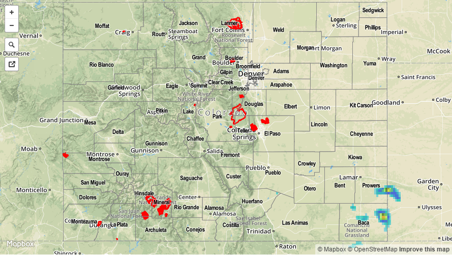
Meanwhile, a few thunderstorms formed in extreme southeastern Colorado (Prowers and Baca counties) shortly after 4PM. While the radar estimated map, below, suggests very heavy rainfall, it is highly unlikely that those estimates were observed at the surface. First of all, the sub-cloud air was extremely dry with relative humidity values in the 20-30% range. Second, ¾ inch hail was reported with the storms, which suggests that hail contamination likely caused overestimates by the radar beam. Third, Prowers and Baca counties are located quite far from any National Weather Service radar sites. This implies that the estimates in the map below were sampling the storms at very high altitudes, where conditions were significantly different than what was observed at the surface. In all, the highest CoCoRaHS official report was only 0.10 inches. Heavier rainfall likely occurred between rain gauges, but nowhere close to the estimates below.
Flooding was not reported yesterday. For estimated rainfall in your area, check out radar-estimated map below (please read the paragraphs above for caveats about these estimates).