Issue Date: Sunday, May 29th, 2016
Issue Time: 9:05AM MDT
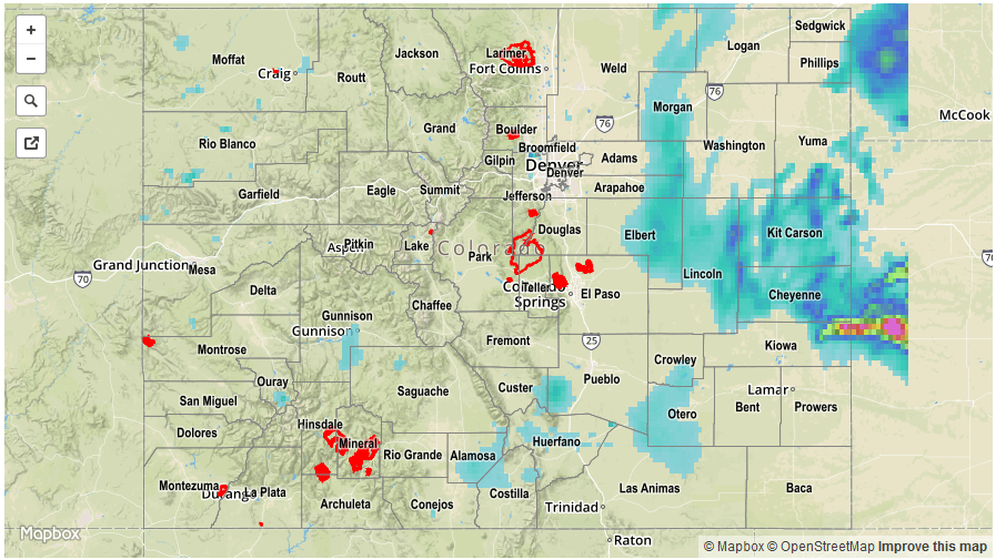
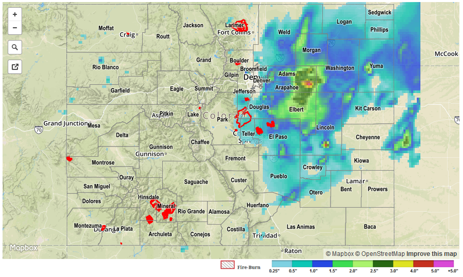
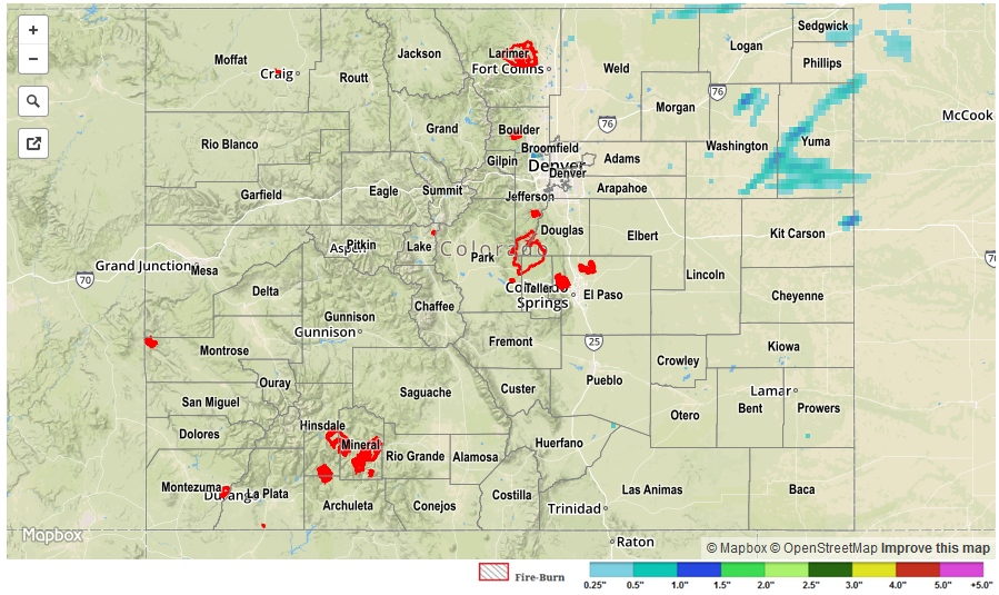
As expected, rainfall coverage continued to decrease on Saturday compared to previous days. True to Colorado standards, sunshine was widespread in the morning, but quickly led to scattered cumulus clouds by noon. Showers and weak thunderstorms popped up across many locations, especially east of the Continental Divide. However, with limited instability in place, most storms were much more impressive looking than what their rain totals would suggest. Highest observed 24-hour amounts ending this morning were about 0.5 inches across eastern Colorado. Between the observation sites, radar estimates up to 0.75 inches are shown for parts of the Northeast Plains.
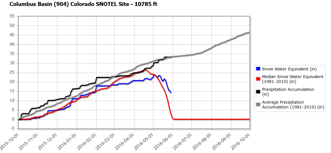
With the warmer temperatures, snowmelt continued though in a very lethargic fashion. An overall cool May (especially when it comes to afternoon high temperature) has put snowmelt at many high-elevation locations about 5-10 days behind schedule. For example, shown below is the Columbus Basin SNOTEL site in the San Juan Mountains (source: NRCS) reading just under 15 inches of snow water equivalent. The site’s median for today is only about 2 inches, and this location is about 9 days behind its average melt schedule. Some great June river rafting seems to be in store across the state!
No flooding reports were received yesterday.
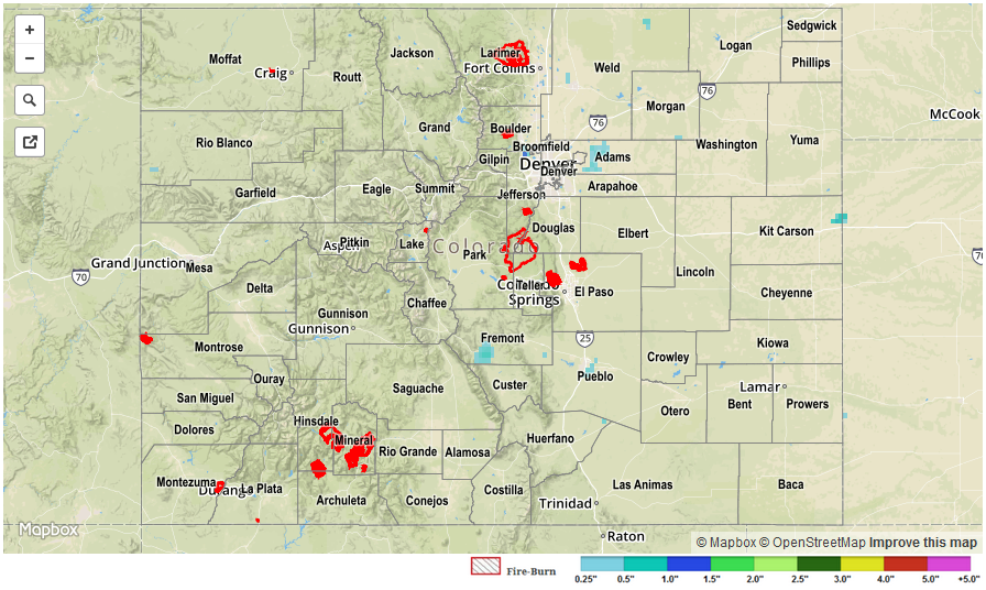
For specific rainfall estimates in your area, please check our STP map below.