STP 06-06-2016: Temperatures Climbed and Thunderstorms Rumbled

Issue Date: Monday, June 6th, 2016
Issue Time: 9:00 AM MDT

Summary:

Temperatures yesterday climbed to above average readings, reaching as high as 10-15 degrees above seasonal norms near the CO/WY border. Meanwhile, a weak shortwave disturbance combined with the heat of the day to produce isolated-to-scattered thunderstorms across the higher terrain, ridges, and adjacent plains/valleys of the central third of Colorado. The strongest storms of the day rumbled across the Southeast Mountains and Raton Ridge, producing bouts with moderate-to-heavy rainfall and one severe hail report (7 miles SSW of Nathrop, Chaffee County).

Rainfall winners, according to CoCoRaHS observers (reports as of 7:00 AM MDT):

Larimer County: 0.19 inches
Weld County: 0.10 inches
Alamosa County: 0.08 inches
Fremont County: 0.05 inches

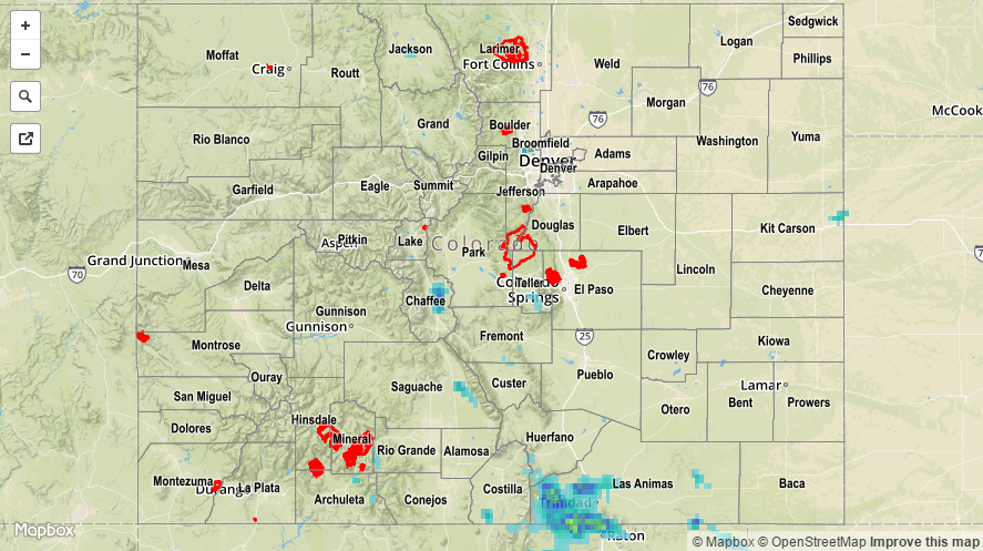
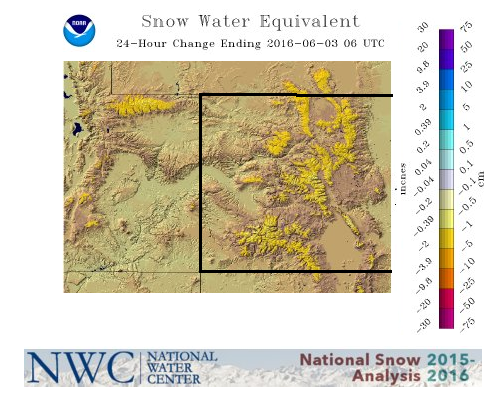
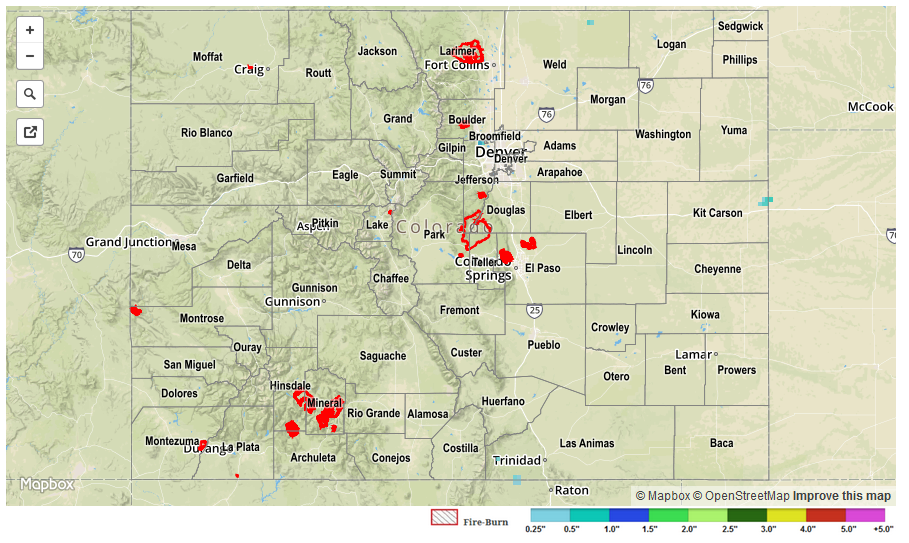
No flash flooding occurred yesterday. Due to scarcity of CoCoRaHS observations in the areas that received some of the best rainfall, please refer to the STP map below for a more complete look at 24-hour precipitation.

20160606_STPImage
Storm Total Precip Legend

STP 06-05-2016: Underneath the Ridge, Heat was the Main Story

Issue Date: Sunday, June 5th, 2016
Issue Time: 9:00 AM MDT

Summary:

The western US ridge remained firmly in place, leaving Colorado under the influence of subsidence. Afternoon high temperatures climbed, asserting themselves as the main weather story yesterday. A few isolated, weak thunderstorms rumbled over the San Juan Mountains and Southeast Mountains during the afternoon/evening as peak heating worked on residual moisture. Rainfall amounts were well below flash flood thresholds.

No flash flooding occurred yesterday. Snowmelt continues with the warm temperatures, and high elevation streams continue to rise. A few raised to near “action” levels, but no flooding was observed. Please see the STP map below for a look at 24-hour precipitation totals.

20160605_STPImage
Storm Total Precip Legend

STP 06-04-2016: Hot West of the Divide, Warm To The East, But Dry Everywhere

Issue Date: Saturday, June 4th, 2016
Issue Time: 8:55AM MDT

The strong western U.S. ridge continued to stay put and perhaps even strengthened a bit on Friday. Locations directly under its grasp baked: Phoenix, AZ saw a high temperature of 113 F, which beat out 2006’s 112 F for a daily record. Even parts of western Colorado, although on the ridge’s eastern periphery saw cloudless skies and very warm temperatures. Cortez and Grand Junction both had high temperatures near 90 F.

Conditions were cooler east of the Divide, with high temperatures right around average, or in the 80-88 F range depending on location. A very weak thunderstorm managed to pop up in the Northeast Plains during the mid-afternoon and hobbled southeastward. Perhaps a tenth of an inch of rainfall fell in lucky areas, but most everyone else received only a great storm panoramic and some virga (rainfall that you can see falling but does not reach the ground).

Flooding was not observed on Friday.

20160604_STPImage
Storm Total Precip Legend

STP 06-03-2016: Toasty and mainly dry; snowmelt well on its way

Issue Date: Friday, June 3rd, 2016
Issue Time: 9:00AM MDT

With a ridge of high pressure overhead, nearly all of Colorado stayed dry on Thursday. The only exception to this was the far southern parts of the Southeast Mountains where a few weak thunderstorms popped up in the mid-afternoon before quietly slipping south into New Mexico. Highest rainfall with these was perhaps a few tenths of an inch but there were no observation stations to catch this.

Elsewhere, as expected, snowmelt is progressing in earnest now. Yesterday saw about 1.0 – 1.5 inches of snow water equivalent melt, evaporate or sublimate across many SNOTEL stations. This is confirmed by the areal gridded analysis, shown below, from the National Water Center. Higher elevation streams are certainly on the rise, but appear to be starting from levels that are low enough to absorb the melting snowpack. Of course, having a stretch of warm and dry days helps since evaporation becomes a strong factor that counteracts the runoff.

SWE_changeFlooding was not observed on Thursday.
STP_20160603