STP 06-30-2016: More Widespread Activity, a Couple Were Strong/Severe

Issue Date: Thursday, June 30th, 2016
Issue Time: 9:00 AM MDT

Summary:

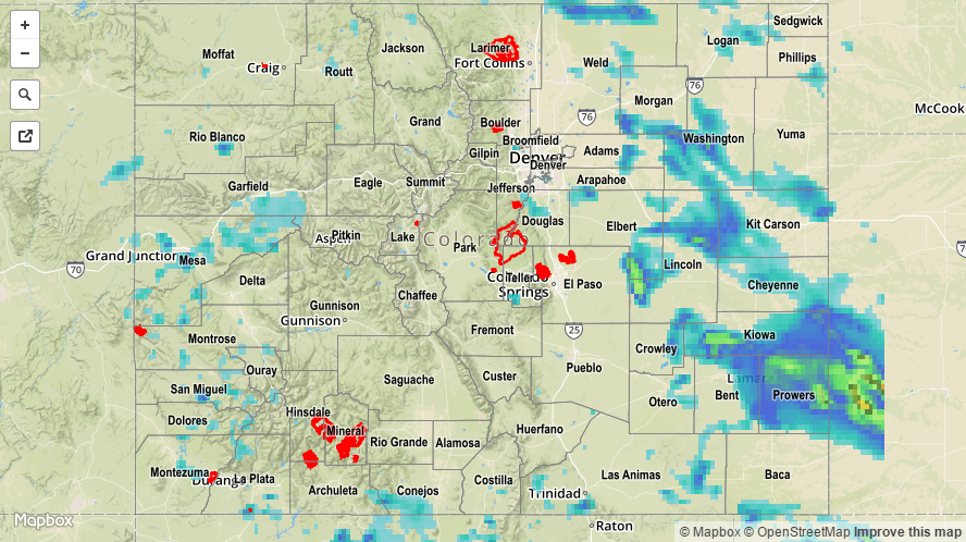
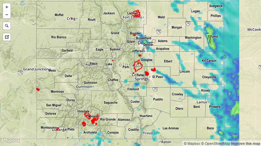
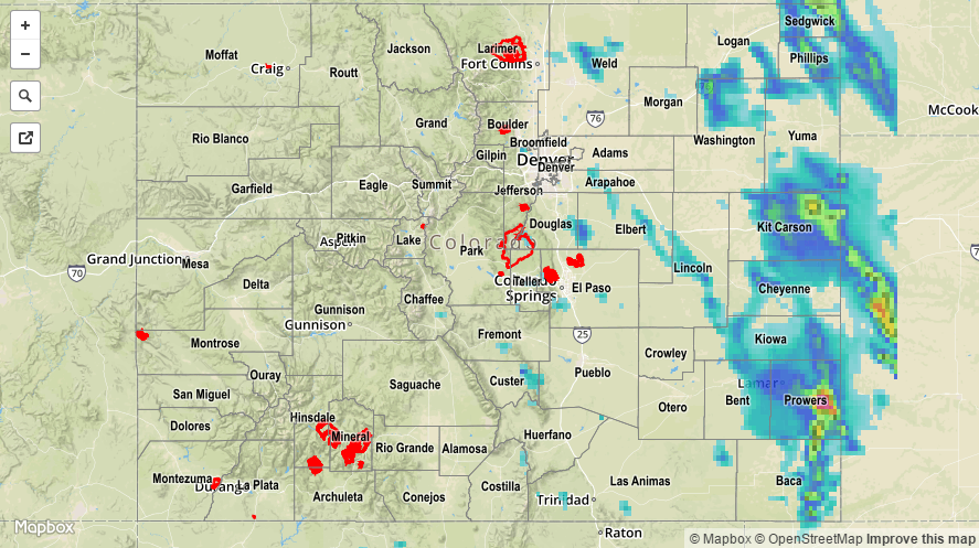
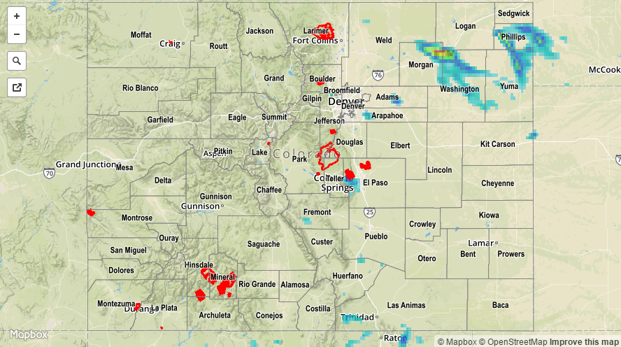
The mid-/upper-level ridge over the ridge weakened slightly, allowing the moisture underneath the ridge to fuel more widespread thunderstorms as compared to previous days. This increase in coverage was noticed most over the mountains as monsoonal moisture crept in from the southwest. Generally speaking most storms over the higher terrain were garden variety, resulting in gusty winds, lightning, and brief light-to-moderate rainfall. A few stronger storms produced brief moderate-to-heavy rainfall, but not enough to result in any flash flooding issues. East of the mountains, and mainly east of I-25, scattered strong/severe storms rumbled, producing hail, strong winds, lightning, and bouts with heavy rain. No flash flooding was reported with these storms either, but they likely resulted in some street/field ponding under the heaviest rain.

Storm reports are as follows:

Funnel Cloud: 3 miles SSW of Montrose (Montrose County)
1.0 inch hail: 5 miles W of Hoyt (Weld County), 1 mile NE of Sugar City (Crowley County)
0.75 inch hail: 2 miles S of Durango (La Plata County)
Thunderstorm Wind Damage: 4 miles NW of Grover (Weld County)
60 mph Wind Gust: 4 miles S of Burlington (Kit Carson County)

No flash flooding was reported yesterday. For a statewide look at 24-hour precipitation totals, please take a look at the Storm Total Precipitation map below.

20160630_STPImage
Storm Total Precip Legend

STP 06-29-2016: Strong/Severe Thunderstorms Rumbled Across Eastern Colorado

Issue Date: Wednesday, June 29th, 2016
Issue Time: 9:00 AM MDT

Summary:

It was an active day across eastern Colorado as scattered thunderstorms rumbled, generally moving from north/northwest to south/southeast. The most intense storm(s) of the day occurred over the Northeast Plains, producing severe winds and large hail, along with flash flooding (more on this in the final paragraph). Much attention surrounded the severe thunderstorm that moved across the Denver metro area during the afternoon, in which hail up to 1.5 inches in diameter was reported. Strong winds blew down trees, while heavy rain generated underpass and intersection ponding/flooding. Additionally, 4 people had to be rescued from high water along Cherry Creek Trail.

Meanwhile, across western Colorado, monsoonal moisture began to creep into the region, setting off isolated-to-scattered showers/thunderstorms. Most activity was garden variety, with lightning and gusty winds being the most notable effects. Locally moderate rainfall attended the strongest storms, relatively speaking.

Severe storm reports are as follows:

Severe Wind Gusts: 7 miles NNW of Alvin (65 mph, Yuma County), 13 miles S of Eckley (60 mph, Yuma County)
1.75 inch hail: 6 miles E of Kirk (Yuma County)
1.50 inch hail: 2 miles NW of Sheridan (Denver County)
1.0 inch hail: Various locations across Washington, Denver, and Yuma counties

Rainfall winners, according to CoCoRaHS observers (reports as of 7:00 AM MDT):

Jefferson County: 1.89 inches
Denver County: 1.58 inches
El Paso County: 1.03 inches
Yuma County: 0.97 inches
Prowers County: 0.77 inches
Kit Carson County: 0.75 inches
Douglas County: 0.74 inches

Flash flooding was reported 6 miles E of Kirk (Yuma County) as 1.54 inches of rain fell in 45 minutes. For a statewide look at 24-hour precipitation totals, please take a look at the Storm Total Precipitation map below.

20160629_STPImage
Storm Total Precip Legend

STP 06-28-2016: Isolated-to- Scattered Thunderstorms Rumbled, a Few were Strong/Severe

Issue Date: Tuesday, June 28th, 2016
Issue Time: 9:00 AM MDT

Summary:

Ingredients came together yesterday to produce another round of showers and thunderstorms, mainly east of the Continental Divide. Generally speaking, the most intense storms occurred over the Northeast Plains where the best combination of strong instability, wind shear, and deep moisture overlapped. Severe storm reports are as follows:

2.75 inch hail: 2 miles WSW of Paoli (Phillips County), 3 miles WNW of Fairfield (Sedgwick County)
2.5 inch hail: 5 miles W of Paoli (Phillips County), Paoli (Philips County)
1.0 – 1.75 inch hail: Various locations across Logan, Sedgwick, Morgan, Weld, Phillips, and Prowers counties
Tornado: Paoli (Phillips County), 8 miles SE of Julesburg (Sedgwick County)
55 mph wind gust: Crook (Logan County)

Rainfall winners, according to CoCoRaHS observers (reports as of 7:00 AM MDT):

Sedgwick County: 1.00 inches
Bent County: 0.97 inches
Kit Carson County: 0.78 inches
Prowers County: 0.55 inches
Lincoln County: 0.33 inches
Elbert County: 0.31 inches

No flash flooding was reported yesterday. For a statewide look at 24-hour precipitation totals, please take a look at the Storm Total Precipitation map below.

20160628_STPImage
Storm Total Precip Legend

STP 06-27-2016: Isolated-to-Widely Scattered Thunderstorms Rumbled

Issue Date: Monday, June 27th, 2016
Issue Time: 9:00 AM MDT

Summary:

Moisture to the east fought back against drier air moving in from the west, providing enough fuel for the development of isolated-to-widely scattered showers/thunderstorms. Activity began during the afternoon hours, with most ending by 9-10 PM. There were a few isolated storms that continued across the Northeast Plains this morning.

The main threats were gusty winds and lightning as most activity remained fairly high-based. However, over the Northeast Plains, better moisture was present and storms were also accompanied by periods of moderate-to-heavy rainfall. Over western Colorado, yesterday was marked by hot and sunny conditions as the dry air was the dominant force.

No flash flooding was reported yesterday. For a statewide look at 24-hour precipitation totals, please take a look at the Storm Total Precipitation map below.

20160627_STPImage
Storm Total Precip Legend