STP 07-08-2016: Passage of a Boundary Sparks Isolated-to-Scattered Thunderstorms

Issue Date: Friday, July 8th, 2016
Issue Time: 9:00 AM MDT

Summary:

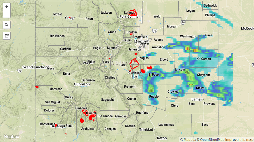
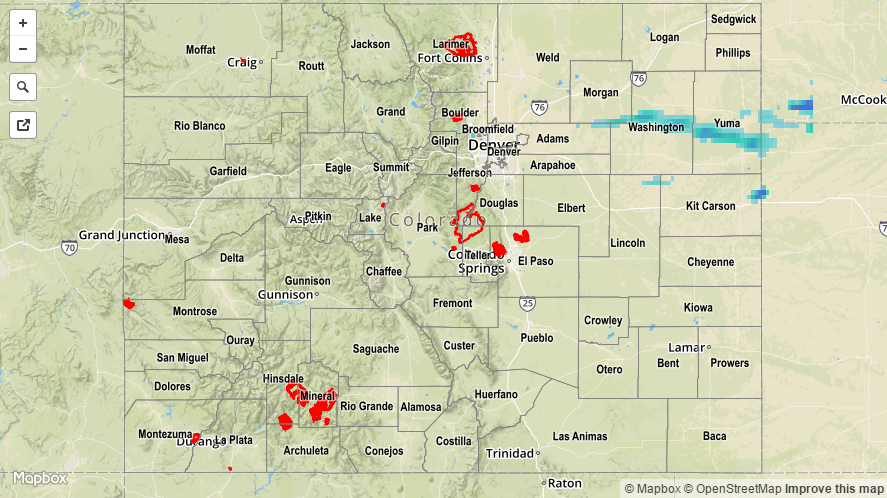
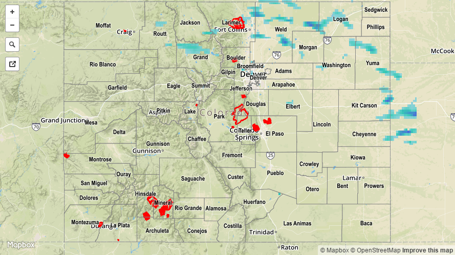
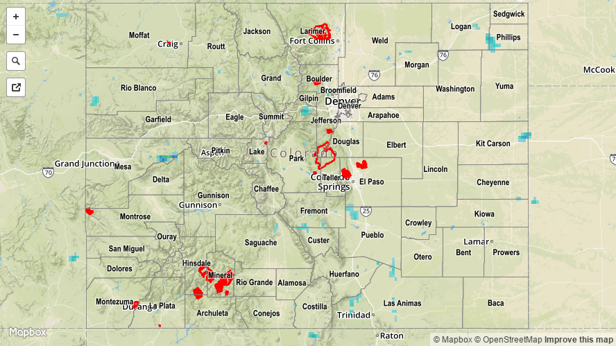
Yesterday morning, it appeared as though moisture would be forced east of Colorado, leaving areas too dry for thunderstorm development. Mother Nature had different ideas, instead passing a cool front/outflow boundary through eastern Colorado and allowing moisture to return in quick fashion. IPW values were in the 25th percentile for the date to begin the day, but by the late evening, IPW values climbed to near/above 1 inch at the Pueblo /Schriever AFB reporting stations and above 0.8 inches at Boulder.

This fuel, combined with the heat of the day, surface convergence, and upslope flow, allowed for isolated-to-scattered strong/severe thunderstorms to develop over the southern half of the Urban Corridor, Palmer Ridge, southern portions of the Northeast Plains, and Southeast Plains. These storms produced periods of heavy rain, hail, and strong winds.

I-25 southbound was closed between exits 96 and 98A this morning due to flooding, and areas underneath strong thunderstorms likely experienced street/field ponding/flooding, especially in poorly drained areas. For a statewide look at 24-hour precipitation totals, please take a look at the Storm Total Precipitation map below.

20160708_STPImage
Storm Total Precip Legend

STP 07-07-2016: Isolated Thunderstorms over Northeastern Colorado

Issue Date: Thursday, July 7th, 2016
Issue Time: 9:00 AM MDT

Summary:

Overall, the main weather story yesterday was the sunshine and heat. Most locations across the state were nearly cloud free, while the Northwest Slope dealt with partly cloudy skies due to its proximity to a cool front across southern Wyoming. Only the far Northeast Plains got in on the thunderstorm action as a dryline set up shop over the far eastern Plains. Yuma County dealt with the strongest thunderstorm(s), isolated in nature, producing strong/gusty winds and brief heavy rain.

For a statewide look at 24-hour precipitation totals, please take a look at the Storm Total Precipitation map below.

20160707_STPImage
Storm Total Precip Legend

STP 07-06-2016: Disturbance Fueled another Period of Showers/Thunderstorms

Issue Date: Wednesday, July 6th, 2016
Issue Time: 9:00 AM MDT

Summary:

Moisture remained fairly steady yesterday across Colorado, with the biggest change being a reduction in moisture over far western counties. A mid-/upper-level shortwave, combined with the presence of a weak cool front, kicked off another period of showers and thunderstorms. The best coverage occurred across northern Colorado, nearest the best support from the disturbance and cool front. The lone storm report came from Routt County, where 0.5 inch diameter hail fell and shredded rhubarb and zucchini leaves. Southern Colorado, especially lower elevations south of Highway 50, remained dry and mostly sunny.

Rainfall winners, according to CoCoRaHS observers (reports as of 7 AM MDT):

Weld County: 0.85 inches
Grand County: 0.40 inches
Yuma County: 0.30 inches
Larimer County: 0.28 inches
Jefferson County, Cheyenne County: 0.20 inches

For a statewide look at 24-hour precipitation totals, please take a look at the Storm Total Precipitation map below.

20160706_STPImage
Storm Total Precip Legend

STP 07-05-2016: Weak Ridging and Lessened Moisture Tempered Rainfall

Issue Date: Tuesday, July 5th, 2016
Issue Time: 9:00 AM MDT

Summary:

Weak ridging aloft and moisture that was slightly less than the previous day led to less shower/thunderstorm coverage overall. Additionally, the environment didn’t support the production of heavy rainfall capable of producing flash flooding, and none was reported yesterday. Generally speaking, the best rainfall coverage occurred over the mountains, mainly along and near the Continental Divide.

Rainfall winners, according to CoCoRaHS observers (reports as of 7 AM MDT):

Las Animas County: 0.40 inches
Larimer County: 0.17 inches
Mesa County: 0.17 inches
Lake County: 0.15 inches
Morgan County: 0.12 inches

For a statewide look at 24-hour precipitation totals, please take a look at the Storm Total Precipitation map below.

20160705_STPImage
Storm Total Precip Legend