STP 09-14-2016: Showers and Storms Dotted The Landscape Once Again

Issue Date: Wednesday, September 14th, 2016
Issue Time: 9:00AM MDT

Summary

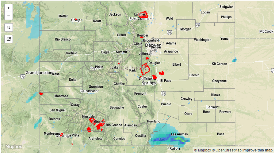
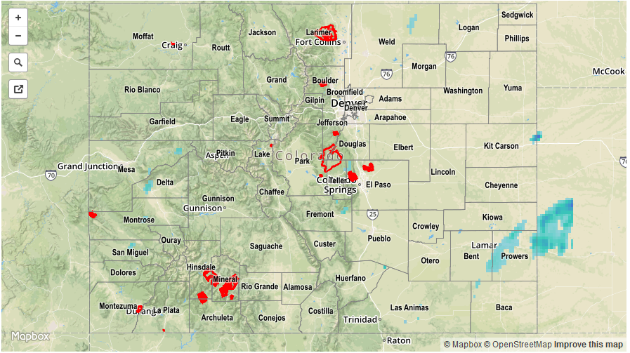
With moisture values recovering over the past 48-hours, showers and thunderstorms increased in coverage on Tuesday compared to Monday. The heaviest action was confined to the higher foothills east of the Continental Divide where ample sunshine boosted temperatures to levels that generated enough instability for storm development. Farther east, a pesky low-cloud deck (a clear signal of fall!) limited sunshine and areas in the Northeast Plains remained in the 50s for their afternoon high temperatures. Where storms did develop, instability was marginal, resulting in light to moderate rainfall amounts. Twenty-four hour rainfall totals were generally up to 0.5 inches across parts of the western slope and eastern foothills. The area of highest rainfall rates was over the Raton Ridge where instability was greatest. There, up to 1 inch of rain fell, likely in 1 hour or less. However, flooding was not reported. Short but heavy rainfall was also reported farther north. For example, an Urban Drainage rain gage in southwest Douglas County notched 0.47 inches in just over 15 minutes, but the storm quickly moved away thereafter.

With the jet stream overhead, high winds continued to be a factor over the western slope. Although thunderstorms there were weak, they provided a mechanism to bring the strong winds aloft to the surface. Similar to Monday, wind gusts up to 56 mph were common with the strongest cells on Tuesday. Fortunately, damage was not reported.

For rainfall estimates specific to your area, check out our Storm Total Precipitation map below.

stp_20160914
Storm Total Precip Legend

STP 09-13-2016: Moisture Recovery Began, Leading to Scattered Showers and Storms

Issue Date: Tuesday, September 13th, 2016
Issue Time: 9:10AM MDT

Summary

The combination of an approaching low-level trough from the west, and a cool front from the north led to changing weather conditions across Colorado on Monday. Moisture recovery (from some of the driest conditions of the 2016 warm season observed on Sunday) began in earnest leading to scattered showers and a few weak thunderstorms across many parts of the state. For example, Grand Junction’s precipitable water value bottomed out at 0.2 inches on Sunday afternoon, then rose to 0.85 inches on Monday before slightly retreating. With only marginal instability in place, light to moderate rainfall rates were the norm. Twenty-four hour rainfall total amounts of 0.25 to 0.5 inches were observed, with slightly heavier rainfall approaching about 0.75 inches seen over the Southeast Plains. Perhaps the more notable weather feature on Monday were the continuation of gusty winds across the higher terrain. Several favored regions across the western slope reported wind gusts in the 45-55 mph range either associated directly with thunderstorms or through the flanking gust flow boundaries. Fortunately, with higher moisture content in the air, the threat of wildfires was substantially reduced compared to Sunday.

Flooding was not reported yesterday. For rainfall estimates specific to your area, check out our Storm Total Precipitation map below.

stp_20160913
Storm Total Precip Legend

STP 09-12-2016: A Shift from Dry to Wet in Some Regions

Issue Date: Monday, September 12th, 2016
Issue Time: 9:00 AM MDT

Summary:

The dry pattern that has defined the weather for the last few days gave way to showers throughout the state with a few isolated thunderstorms in the Southwest Slopes and the San Juan Mountains.  The area of high pressure that had moved over the state yesterday gave way to a low-pressure trough that began to move in from the north.  Moist low-level air from the south and southwest helped spark off showers throughout the day.  Spotty showers began to move in from the west into the Grand Valley and Southwest Slopes in the morning hours and quickly spread eastward over the San Luis Valley in the mid-afternoon and southern portions of the Eastern Plains by the late afternoon and early evening hours.    Throughout the evening and night hours, spotty showers also moved eastward through northern portions of the Northeast Plains with the encroachment of the low-pressure trough from the north.   Observed rainfall totals were in general light with a few very localized heavier amounts, but rainfall thresholds for flooding were not exceeded.

For a closer look at rainfall totals in your area, please see the STP map below for a look at 24-hour precipitation totals.


Storm Total Precip Legend

STP 09-11-2016: A Very Pleasant Saturday Afternoon

Issue Date: Sunday, September 11th, 2016
Issue Time: 9:00 AM MDT

Summary:

A strong area of high pressure was the story of the day as sunny and dry conditions prevailed over the entire state, with the exception of a slight shower over the border of the Northwest Slopes and Northern Mountains in the early afternoon, little of which likely made it to the ground. Temperatures remained seasonal and cooler throughout the Eastern Plains and Urban Corridor, with warming temperatures making their way into the High Country due to warm westerly/southwesterly desert winds increasing in the late afternoon. Overall, it presented a nice opportunity to enjoy a Saturday afternoon outdoors, which seemingly does not occur often enough.

For a closer look at rainfall totals in your area, please see the STP map below for a look at 24-hour precipitation totals.


Storm Total Precip Legend