STP 06-13-2017: A Few Severe Storms With Large Hail and Tornadoes

Issue Date: Tuesday, June 13th, 2017
Issue Time: 9:45AM MDT

Summary:

Impressive amounts of low-level moisture were noted on Monday morning across Colorado. Morning dew point temperatures were above 60F across wide areas of the northeast part of the state, with precipitable water exceeding 1.0 inch in a few locations. With a strong approaching disturbance, this could have led to quiet the setup for heavy rainfall. However, two factors mitigated this. First, moisture was quite shallow, which was put on clear display in the early afternoon hours as foothill locations in the Palmer Divide and Front Range experienced a 25F or more drop in the dew point temperature as the boundary layer grew in height and mixed down drier air aloft. Second, the storm steering winds increased in speed to over 40mph. Thus, for the storms that did develop, they were not in one location for very long.

Instead of heavy rain, there were two stories that dominated the weather headlines on Monday. First, several supercell thunderstorms developed in the northern Urban Corridor and Front Range. These storms had access to high amounts of instability, speed and directional shear, creating the perfect setup for strong, rotating updrafts. The result was numerous reports of large hail, as large as 4.25 inches in Weld County. In addition, tornado reports were received in Weld and Larimer counties. Max rainfall with these storms was up to 0.75 inches, with most of that falling in 30 minutes or less.

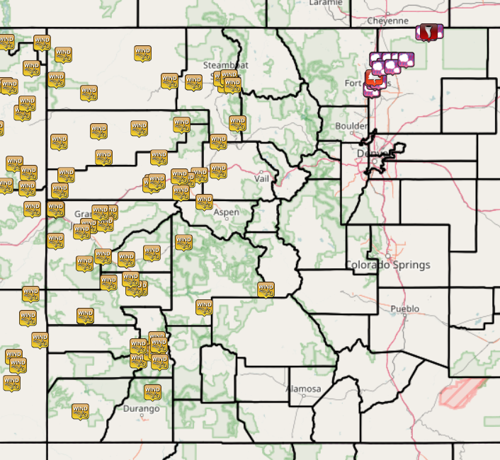
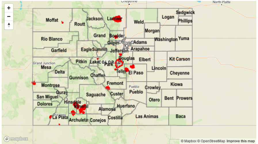
The second main story was the very windy conditions across western Colorado, as shown in the map below. A report is only recorded if it exceeds 45 mph, and many of the reports below were in excess of 60 mph. With low relative humidity, two more “large incident” fires appeared on Monday: the Dead Dog and Hunter fires, both in Rio Blanco county. Stay tuned to the Grand Junction National Weather Service for updates on these, and fire forecasts.

Flooding was not reported on Monday. For precipitation estimates in your area, check out the State Precipitation Map below.

Storm Total Precip Legend

STP 06-12-2017: Approaching Disturbance Supported Isolated Severe Storms

Issue Date: Monday, June 12th, 2017
Issue Time: 10:55AM MDT

Summary:

Stubborn moisture continued to hang on in eastern Colorado with dew point temperatures of 50-60F being common. Despite the high moisture in the lower levels, upper-level moisture was lacking due to strong dry air transport from the west. With plenty of sunshine, instability was in abundant supply by early afternoon but only a handful of storms managed to form in two main areas: in the Front Range and Northeast Plains. In the latter storms were very short-lived, with perhaps a few tenths of rainfall at best. In the former, two discrete storms formed in the late afternoon, prompting a severe thunderstorm warning. Hail up to 1.75 inches was reported In Phillips County. However, heavy rainfall was very brief, amounting to perhaps 0.75 inches, though this was limited to a very localized area.

West of the Continental Divide, dry and hot conditions prevailed with gusty winds being added to the mix. The Temple fire continued to burn in Rio Blanco County, growing substantially through the day. Information about this fire can be obtained through the Grand Junction National Weather Service, and by monitoring the #TempleFire feed on Twitter.

Flooding was not reported on Sunday. For precipitation estimates in your area, check out the State Precipitation Map below.


Storm Total Precip Legend

STP 06-11-2017: Dry and Hot

Issue Date: Sunday, June 11th, 2017
Issue Time: 9:00 AM MDT

Summary:

There isn’t much to say about yesterday’s precipitation, considering no precipitation fell anywhere in Colorado. Warm, dry air aloft led to a “severe clear” day/night, with hot temperatures and elevated fire danger being the main weather concerns. The hot temperatures have kept area streams/rivers running high and fast due to rapid snowmelt.

No flooding occurred yesterday. Please see the STP map below for a look at precipitation totals from the last 24 hours.


Storm Total Precip Legend

STP 06-10-2017: Heat and Dry Conditions Won the Day

Issue Date: Saturday, June 10th, 2017
Issue Time: 10:10 AM MDT

Summary:

Very dry air overtook Colorado yesterday, leading to a day filled with sunshine and warming temperatures. Minor flooding occurred along the Arkansas River near La Junta, and numerous streams ran high, due to rapid snowmelt caused by the hot temperatures. This will continue today, as mentioned in the Flood Threat Bulletin.

No flooding occurred yesterday. Please see the STP map below for a look at precipitation totals from the last 24 hours.

Storm Total Precip Legend