Issue Date: Friday, July 5th, 2019
Issue Time: 11:00 AM MDT
Summary:
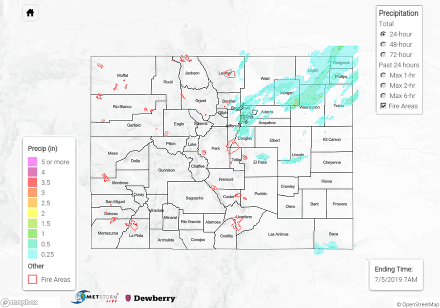
High levels of surface moisture and a passing shortwave produced heavy rainfall and hail over the Urban Corridor and Northeast Plains. Slow southerly steering winds combined with deep convection produced severe storms over the Urban Corridor, with reports to NWS of 1.5 inch diameter hail over Monument, and 2 inch diameter hail near Parker. CoCoRaHS stations along the Urban Corridor reported rain between 0.3 and 0.7 inches, with isolated reports of up to 1.03 inches in Arapahoe, Denver, and Adams Counties. Early evening storms that initiated over the Cheyenne Ridge produced up to 1.13 inches in Logan County. Radar derived estimates over the Northeast Plains produced up to 1.5 inches in southeastern Morgan and Northern Washington Counties. A few isolated storms over the Palmer Ridge and Southeast Plains also showed radar derived estimates of up to 0.5 inches.
Minor flood stage was maintained throughout the day yesterday along the Arkansas River near Avondale. Rivers remain swollen in the high country due to snowmelt and dam releases. For more information on river levels, please visit today’s FTB.
To see estimated precipitation totals over your neighborhood yesterday, scroll down to the State Precipitation Map below.
Click Here For Map Overview