Issue date: Wednesday, July 3, 2019
Issue time: 10:55 AM MDT
Summary:
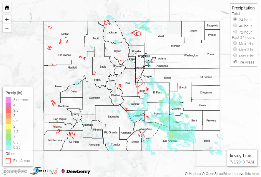
Upslope flow was the primary source yesterday that lead to scattered showers over the high country, Urban Corridor, and Southeastern Plains. Surface moisture was widespread once again, with maximum relative humidity greater than 80% for the western two thirds of the state. Surface flow from the west kept things dry over the western border, as arid air from Utah and Arizona made its way in behind a weak shortwave in Utah. Upslope flow off of the Cheyenne Ridge lead to an isolated report of 0.79 inches from Buckeye RAWS station north of Wellington in Larimer County. The southern Urban Corridor had some very heavy rainfall rates during the afternoon, with an ALERT gage in Douglas County measuring 0.63 inches in 15 minutes. The 1 hour total was just under 1 inch at this gage. Radar indicates up to 1 inch fell with the storms in the area.
Storms moved east off of the Raton Ridge and Southwest Mountains and made their way to the Arkansas River Basin by early last night. CoCoRaHS stations reported 0.35 and 0.28 inches at Pueblo and La Junta Airports, respectively. Radar derived rainfall estimates were just over 1.5 inches in Las Animas, Bent, El Paso and Crowley Counties. This makes sense as higher moisture was present over the area as well as slower steering winds, which helped increase the rainfall efficiency of storms. There were two Flood Warnings issued for the Spring Creek and Junkin burn areas where radar estimated between 0.25 and 0.50 inches of rain fell. As of this morning, there was no flooding reported.
Gages will remain in Action stage throughout the day along the Arkansas, Eagle and Rio Grande Rivers. There are Flood Warnings for the Arkansas and Eagle River at Gypsum. The Blue River below the Dillon Reservoir rose into Action stage yesterday morning due to dam releases. The Conejos River in Conejos County had reports of minor flooding in low lying areas throughout the county. Please see today’s FTB for the latest on the high flows.
To see estimated precipitation totals over your area on Tuesday, scroll down to the State Precipitation Map below.
Click Here For Map Overview