Issue Date: Friday, June 28th, 2019
Issue Time: 10:55 AM MDT
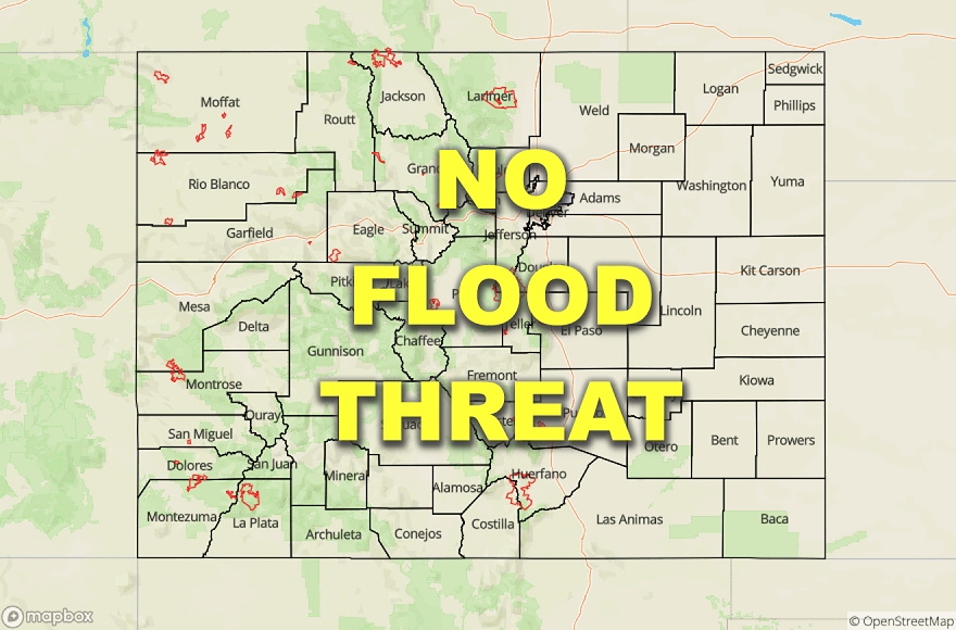
—Flooding is NOT expected today
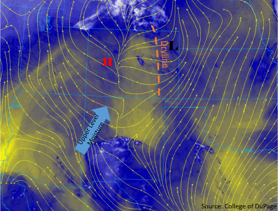
Colorado’s weather pattern has not changed much over the last few days. Upper level flows remain weak out of the southwest (blue arrow in image below), with mid-level moisture slowly creeping its way into the state throughout the day and into tomorrow morning. High pressure remains centered over the high country, providing downslope flow throughout the morning and into the early afternoon (yellow surface streamlines). A broad region of low pressure sits over the eastern plains advecting in hot, semi-moist air to the far eastern plains. These two features will converge, creating a dryline over the area by this afternoon. Moisture arriving from the east will mix out throughout the day, keeping skies clear and precipitation chances negligible.
Southerly to southwesterly flow along the New Mexico and Utah boarders will bring in hot, relatively moist air at the surface, providing rain chances for this afternoon and early evening. A weak, mid-level shortwave and local vorticity maximum will move over the southern edge of the state early this evening, helping provide lift to weak thunderstorms. Moisture will be primarily in the lower and mid-levels, but high-based thunderstorms are expected over the southwest quadrant of the state later this afternoon and evening. Additional storm activity over the southern Front Range and Central Mountains will initiate with residual moisture under the ridge by midday. Activity will likely move into the adjacent plains over the southern Urban Corridor, Palmer Ridge and Raton Ridge areas. Flooding is not forecast.
Surface temperatures are expected to increase slightly from yesterday’s values over the eastern plains. Downsloping flow and sunny skies this morning will allow temperatures to increase rapidly. Highs in the mid 100°Fs are forecast for the Southeast Plains, with temperatures in the 90°Fs for most areas west of the foothills. Over the high country, high temperatures are expected to be in the 80°Fs once again, decreasing down into the 60°Fs over the highest elevations. The Grand Valley is also forecast to be in the 90°Fs and dry at the surface.
Today’s Flood Threat Map
For more information on today’s flood threat, see the map below. For Zone-Specific forecasts, scroll below the map.
Zone-Specific Forecasts:
Southwest Slope, San Juan Mountains, Central Mountains, Grand Valley, Front Range, Urban Corridor, Southeast Mountains, Raton Ridge, Palmer Ridge
High-based, weak thunderstorms and showers are forecast for this afternoon into tonight. Southwest flow and a mid-level shortwave will create lift for thunderstorms over the southwest corner of the state. Diurnal flow will provide lift and forcing for showers and thunderstorms over the Front Range, and Central Mountains by midafternoon. Most precipitation is expected to evaporate prior to reaching the surface, so most surface accumulation will be light or confined to the upper elevations. Maximum 1-hour accumulations of 0.3 inches are expected over the San Juan and Central Mountains, with maximum 1-hour accumulations of 0.15 inches over the Front Range, Urban Corridor and Palmer Ridge. Gusty winds (up to 35 mph) are expected near the storms vicinity once again today. Thunderstorm and light rainfall may last a couple hours after sundown with the shortwave overhead, but activity should end as instability decreases.
Primetime: 2PM to 12AM
Northwest Slope, Northern Mountains, Northeast Plains, Palmer Ridge, Southeast Plains, San Luis Valley
Conditions will be hot and dry over the area today, with little to no precipitation expected as storms will dissipate as they move east away from the lifting source and into drier air. Morning downsloping winds and warm air advection will keep these regions hot and dry. Snowmelt will continue for another day, but river levels remain steady and below Action stage over the Northern Mountains.