Issue Date: 6/22/2015
Issue Time: 11:30 AM
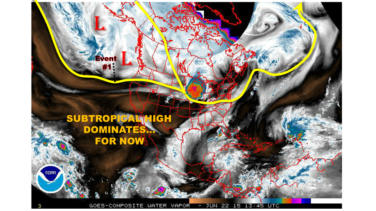
The end of June to early July is climatologically a transition period over most of Colorado. And 2015 appears to be following that script. The springtime jet stream is retreating northward, while losing strength. Meanwhile, the land-sea temperature contrast is not quite strong enough to induce the moisture laden monsoonal flow that typically establishes itself by mid July. As we see in the water vapor image, below, the short-term weather (or lack thereof!) will be exclusively dictated by subtropical high. However, after the 4th of July, model guidance suggests that the door will be open to the first push of monsoonal moisture.
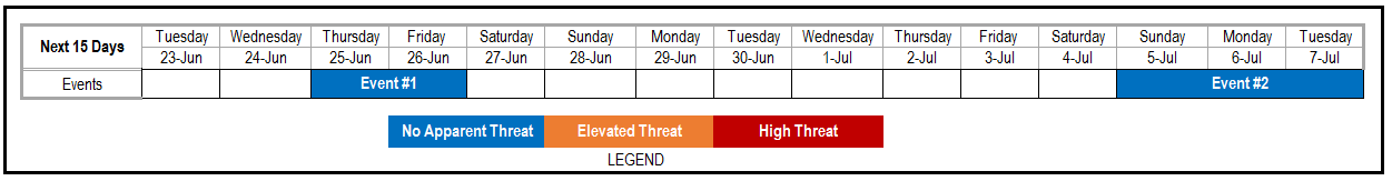
During this Outlook period, covering 6/23 through 7/7, we see two precipitation “Events”:
- Event #1: Thursday (6/25) – Friday (6/26)
- No apparent flood threat as a weak disturbance increases rainfall chances mainly for the Southeast Plains
- Event #2: Sunday (7/5) through Tuesday (7/7)
- No apparent flood threat (at this time) as monsoonal moisture will promote thunderstorm activity across the southern part of the state
Event 1: Thursday (6/25) – Friday (6/26)
No apparent flood threat
A weak “ridge-rider” type disturbance will increase thunderstorm chances mainly across the Southeast Plains on Thursday and Friday. However, rainfall is anticipated to stay in the 0.5 to 1 inch range and no flooding concerns are anticipated.

Event 2: Sunday (7/5) – Tuesday (7/7)
No apparent flood threat
After dominating the scene for a 7-10 day period, the subtropical high pressure ridge will weaken and allow the season’s first monsoon surge to visit Colorado. While there is not enough confidence yet to issue for an Elevated threat, we do expect rainfall chances to be highest in the climatologically favored southern half of the state. At this time, rainfall is expected to stay in the 0.5 to 1 inch range.
Longer-range outlook
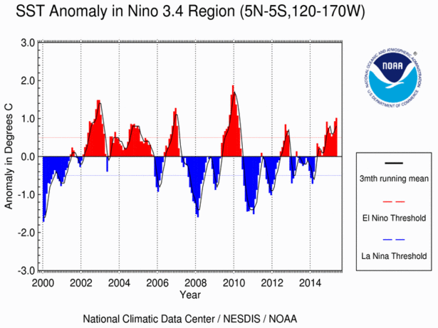
In the longer-range, conditions are still very conducive to higher than normal precipitation across most of Colorado. Most of this anticipation is based on a continually strengthening El Nino in the Pacific Ocean. The chart below shows that one measure of El Nino, the 3.4 Index, is now the highest since 2010. Almost all longer-range guidance continues to suggest a maintenance or further strengthening of El Nino in the fall. This kind of consensus increases confidence that the above average rainfall that started in May will continue.