Issue Date: Thursday, June 27th, 2019
Issue Time: 10:50 AM MDT
Summary:
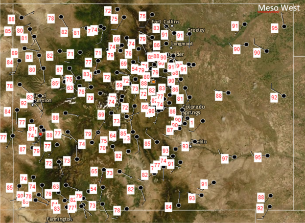
It finally felt like a normal late June day yesterday as temperatures increased again statewide. Highs reached into the 90°Fs over the plains, and into the 70°Fs throughout much of the high country (see map below). A weak midlevel disturbance came over the mountains from the southwest yesterday, enhancing surface convergence, and helping to produce showers over the Northeast Plains, Front Range, Palmer Ridge and Urban Corridor. Surface reports from CoCoRaHS measured only a trace in these areas, with a statewide max of 0.05 inches in Morgan County. Radar estimated rainfall was 0.25 inches in Morgan and Douglas County, but dry air underneath the cloud base reduced accumulations significantly. Winds were gusty underneath the virga, with Fort Morgan Municipal Airport reporting gusts of 23 mph around 6PM.
No flooding was reported yesterday and waters all along the Arkansas River have retreated below Action stage. The Rio Grande River near Alamosa remains at Action stage but flows are forecast to remain steady throughout today.
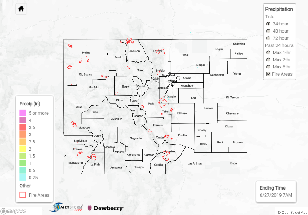
To see estimated precipitation totals over your area yesterday, scroll down to the State Precipitation Map below.
Click Here For Map Overview