Issue Date: Tuesday, June 18th, 2018
Issue Time: 10:35 AM MDT
Summary:
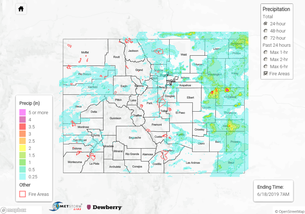
Few areas of the state remained dry yesterday as a shortwave passed over the state, helping spark numerous showers and thunderstorms. A surface low on the central eastern plains helped pull in some high moisture values for heavy rainfall under slow steering winds. A break in the clouds by mid-morning allowed for surface heating and convective instability to build, which helped produced several severe thunderstorms over the Grand Valley, Southeast Plains, Northeast Plains and Urban Corridor. A severe storm near Chivington in Kiowa County produced flash flooding (causing parts of Colorado 96 to wash out), a weak tornado and 1.75 inch hail. Radar estimates up to 4 inches of rain fell in Kit Carson County over a 2-hour period, which is a 1 in 200 year event.
Multiple hail reports were recorded in Pueblo County, with the largest hail recorded at 2.5 inches. Weak upper level winds allowed the storms to linger within the area, resulting in a rain report of 2.25 inches and winds up to 69 mph at Pueblo Memorial Airport. Glade Park in Mesa County recorded 0.75 inches of rain. Storms yesterday also produced a lot of wind. A gust of 70 mph caused downed power-lines in Baca and a gust of 62 mph was recorded over Boulder County associated with a storm in the area. For the storm in Boulder, the UDFCD ALERT network recorded an inch of rain in 30 minutes. As of this morning, there were no flood reports with this storm.
As far as riverine flooding, gages remain high over the Arkansas River downstream of Pueblo Dam. The Nepesta gage temporarily dropped below Action stage, but has returned this morning. There was also an increase in flow at the La Junta gauge. Over the southwest, there were reports by emergency management of minor flooding issues along the headwaters of the Rio Grande and in central Saguache County. This will continued to be monitored in the daily FTB.
For a look at yesterday’s widespread precipitation, please see our State Precipitation Map below.
Click Here For Map Overview
