Issue Date: Sunday, June 9th, 2019
Issue Time: 9:25AM MDT
Summary:
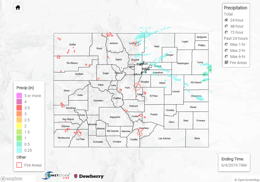
Rainfall yesterday was mostly confined to the northeast corner of the state as the trough pushed through the state. A Severe Thunderstorm Watch was issued during the afternoon. The first set of storms formed over the KS/CO border in the early afternoon, but quickly exited the state to the east. Two landspout reports came in from Kit Carson and Yuma, but as of this morning, there was no damage reported. Quite a bit of rainfall accumulated over these counties as well with the back building storms. Totals just over 1.5 inches were estimated by radar. Additional storms set up over the eastern Front Range during the afternoon, which brought a showers and thunderstorms to the Urban Corridor. These storms produced 0.5 inches of rain with hail reports up to 1.5 inches over north Denver. A wind gust of 64 mph, hail up to 1.75 inches and another tornado were reported with a severe storm in Elbert County. So as anticipated when the front dropped south, severe thunderstorm activity increased over the adjacent plains. Flooding was not reported with any of these storms.
Melting over western Colorado, especially southwest Colorado, continued to increase runoff. Flooding from snowmelt and debris flows were reported near Wolf Creek Pass again overnight. This area remains under a Flood Warning. The Flood Warning for the San Antonio and Conejos Rivers in southeastern Conejos County continues as well (through Monday evening). The public reported flooding throughout the headwaters of the Rio Grande and San Juan Rivers, so a more broad Flood Warning was put in place (see today’s FTB) with Del Norte still experiencing minor flooding. Willow Creek in north central Mineral County also had flooding issues on the south side of town. Finally, an advisory was issued for west, central Rio Grande County. Areal Flood Advisories also persisted for the Gunnison River above Grand Junction, the La Plata River at Hesperus and for the Mancos River in Montezuma County. For the latest warnings and advisories, see today’s FTB post as well as NWS Grand Junction and Pueblo.
AHPS gages (click me!) currently at Action or Minor Flooding Stages:
- Mancos River near Mancos
- La Plata River above Hesperus
- San Juan River at Pagosa Springs
- Navajo River near Chromo
- Rio Grande near Del Norte
- Eagle River at Gypsum
- Gunnison River at Delta
To see estimated precipitation totals over your area on Saturday, scroll down to the State Precipitation Map below.
Click Here For Map Overview