Issue Date: Saturday, June 8th, 2019
Issue Time: 9:35AM MDT
Summary:
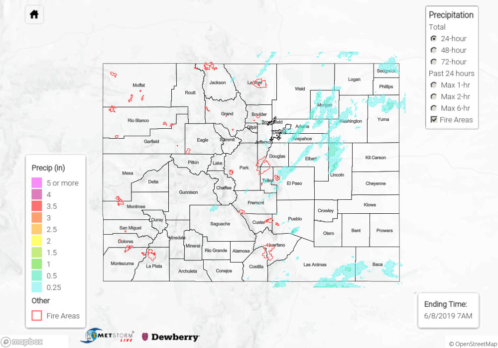
Southwest flow yesterday allowed storms that fired over the high terrains to move into the adjacent eastern plains again. For the most part, western Colorado remained dry with only trace amounts of rainfall picked up by radar estimates. These were mostly along the Continental Divide. Eastern Colorado had a bit more moisture to work with, but the highest dew points were west of 104W. Thus, as storms moved into the adjacent plains, they became more efficient rainfall producers. Over the Urban Corridor, totals up to 0.45 inches were recorded in Aurora. The storms formed a line over the Northeast Plains/Palmer Ridge where totals just under 1 inch were estimated by radar. Hail up to 1.25 inches was reported in Limon and Weld Counties with a gust of 60 mph recorded in Akron. The bulk of the thunderstorm activity ended a couple hours after sundown.
With another day of hot temperatures over western Colorado, snowmelt and runoff continued to increase. Flooding from snowmelt and debris flows were reported near Wolf Creek Pass, which recently opened (as of 8AM). Water was 6 inches deep and road crews were unable to keep the debris and mud flows from stopping as of 2AM. This area is still under a Flood Warning. The Flood Warning for the San Antonio and Conejos Rivers in southeastern Conejos County continued as well (through Monday morning). The Areal Flood Advisories also persisted for the Gunnison River above Grand Junction, the La Plata River at Hesperus and for the Mancos River in Montezuma County for minor lowland flooding. These advisories continue until further notice by the NWS. For the latest warnings and advisories, see today’s FTB post as well as NWS Grand Junction and NWS Pueblo.
To see estimated precipitation totals over your area neighborhood on Friday, scroll down to the State Precipitation Map below.
Click Here For Map Overview