Issue Date: Thursday, June 6th, 2019
Issue Time: 9:00AM MDT
–A LOW flood threat has been issued for portions of the San Antonio and Conejos Rivers
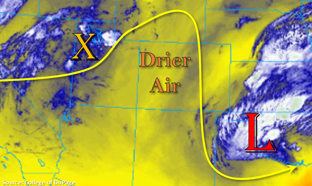
With the low to south and east of Colorado, the state will sit between two systems today. This will allow a weak ridge to begin to build back over the state and high temperatures to increase a couple of ticks on the thermometer compared to yesterday. The water vapor imagery below shows drier air over and around the area, which is indicated by the shades of yellow. Expecting most of the current low level moisture to mix out throughout the day, which should limit the coverage of the afternoon storms. Storms will be mostly confined to the mountains this afternoon and evening with steering winds from the north. The main threats will be gusty winds, brief/moderate rainfall and lightning. There is some weak mid-level energy over western Utah, which may help spark a couple additional showers over the northwest corner of the state this afternoon and evening, but flooding is not forecast. A Low flood threat has been issued for the San Antonio and Conejos Rivers, which are currently under a Flood Warning through Monday morning for minor flooding.
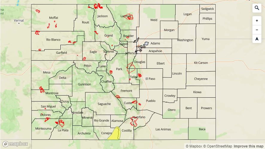
Today’s Flood Threat Map
For more information on today’s flood threat, see the map below. For Zone-Specific forecasts, scroll below the map.

Zone-Specific Forecasts:
Front Range, Southeast Mountains, San Juan Mountains, San Luis Valley, Northern Mountains, Central Mountains:
The bulk of the afternoon, diurnally driven storms will occur over the mountains. With a little better moisture to the east, expecting coverage today to be greatest over the Front Range, Southeast Mountains and eastern San Juan Mountains. Max 1-hr rain rates of 0.35 inches are possible with the stronger storms as well as small hail. Over the Central and Northern Mountains, rainfall will favor the north facing slopes with more limited coverage. Totals are expected to remain under 0.1 inches in these areas. A Low flood threat has been issued for portions of the San Antonio and Conejos Rivers with minor flooding expected over the next several days. The Flood Warning by the NWS has been extended through Monday morning.
Primetime: 2PM to 9PM
Raton Ridge, Palmer Ridge, Urban Corridor, Northeast Plains, Southeast Plains, Northwest Slope, Grand Valley, Southwest Slope:
With northerly storm motion, not forecasting rainfall over these areas this afternoon. The exception is over the Northwest Slope where some mid-level energy may spark some weak showers later this afternoon. With low dew points most storms will produce virga and brief gusty winds. Totals should remain under 0.05 inches. Some wrap around rainfall from the low may be possible over Baca Country this afternoon, but most of the latest model runs are keeping this rainfall east and south of the area. If these occur, expect totals (at most) to reach 0.3 inches.
Primetime: 3PM to 9PM