Issue Date: Wednesday, May 29th, 2019
Issue Time: 8:30AM MDT
–Flooding is NOT expected today
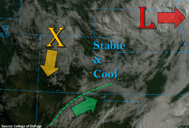
Busy visible satellite image below to start Wednesday. Over Nebraska, the low pressure system that has affected our weather the last couple of days will begin to move east and break apart. A vorticity max has broken off the back side of the low and is currently over the northwest corner of the state. This will slide south throughout the day and help spark some scattered showers and weak thunderstorms over the mountains this afternoon in tandem with the diurnal flow. Lastly, there is a weaker wave brushing the southern border that is helping produce some early morning cloud cover in the wake of the cold front over the Southeast Mountains and Raton Ridge. Expecting this feature to move to the ENE throughout the day, which should help spark a few weak thunderstorms and rainfall over the Raton Ridge this afternoon. A stable and cool air mass will remain intact over the Eastern Plains, which will reduce high temperatures today. Storms that move into this area are forecast to dissipate quickly, so only trace amounts of accumulation (if any) are forecast for this region.
Diurnal flow, residual moisture and the vorticity max will start to spark scattered rainfall and weak thunderstorms over the mountains beginning later this morning. The snow line should remain above 10,000 feet, so this will not be a major winter weather event. Weak steering winds will allow storms to fester over an area for a couple of hours, so totals up to 1 inch are possible over the Central and southern Front Range Mountains near the Divide. The stratiform rain pushes into the adjacent plains late this afternoon, but outside of the immediate adjacent plains where the Palmer Ridge will help provide a little more convergence, storms are expected to dissipate quickly. Rain accumulations are expected to stay west of I-25. Flooding is not expected.
Today’s Flood Threat Map
For more information on today’s flood threat, see the map below. For Zone-Specific forecasts, scroll below the map.

Zone-Specific Forecasts:
Front Range, Northern Mountains, Southeast Mountains, San Juan Mountains, Central Mountains, Urban Corridor, Palmer Ridge, Raton Ridge:
Scattered storms with gradual accumulating rainfall are expected over the mountains today with the highest accumulations forecast along the Continental Divide where a little more convection is possible. Isolated 24-hour totals over the eastern Central Mountains, southern Front Range may reach 1 inch, but max 1-hr rain rates will stay below 0.35 inches. Over the Southeast and San Juan Mountains, 24-hour totals will be closer to 0.5 inches. Rainfall is forecast to move into the adjacent plains over the Palmer Ridge area (accumulations west of I-25) this afternoon with max 1-hr rain rates of 0.2 inches possible. Further south, the Raton Ridge storms may produce totals up to 0.4 inches closer to the Southeast Mountains. Small hail is possible with the weak thunderstorms this afternoon along with some brief gusty winds, but severe storms are not forecast. Storm will come to an end a couple hours after sundown, and flooding is not forecast.
Primetime: 11AM to 11PM
Northwest Slope, Grand Valley, Southwest Slope, Northeast Plains, Southeast Plains, San Luis Valley:
Cooler temperatures have worked their way into southern Colorado. Expect high temperatures to remain below average throughout the day with highs in 60°Fs. With a stable air mass in place over the eastern plains and western valleys, storms should dissipate as they move into the areas. Thus, accumulation will be zero to trace amounts at most. The best chance for accumulation is over northern portion of the Southwest Slope, but totals will remain under 0.1 inches. Flooding is not expected.
Primetime: 11AM to 8PM