Issue Date: Friday, May 24th, 2019
Issue Time: 9:05AM MDT
Summary:
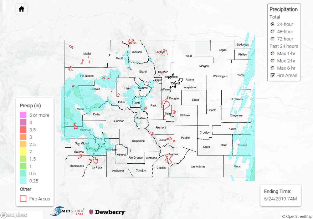
A quick moving system brought widespread showers to western Colorado yesterday. A cold front moved through during the afternoon hours, which dropped the snow line and allowed for decent accumulations above 8K feet. Vail reported another 3.5 inches of snow. For rainfall, the highest 24-hour total was over Garfield County near De Beque where 0.69 inches was recorded. Overall, widespread totals were 0.25 inches or higher. With saturated soils, rises were noted in the rivers and creeks, but no flooding was reported with levels well below Action stage. Windy conditions were also present over with the jet overhead. A gust of 60 mph was recorded over Rifle with another gust of 67 mph recorded at the Alamosa Airport ASOS. Over the eastern border, weak thunderstorms formed over the border counties during the late morning into the afternoon where up to 0.5 inches was estimated to have fallen from radar.
To see estimated precipitation totals from Thursday, scroll down to the State Precipitation Map below.
Click Here For Map Overview