Issue Date: Thursday, May 23rd, 2019
Issue Time: 11:45PM MDT
Valid Dates: 5/24 – 6/7
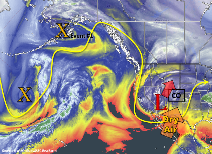
The water vapor imagery below shows the low that will affect our weather today into tonight as it moves swiftly to the northeast. In its wake, dry air will work into the area confining scattered thunderstorms to the higher terrains tomorrow with limited coverage. Saturday, the dry air mass shown with the orange arrow below will be well in place with southwest flow, which should allow only minimal afternoon convection over the mountains. This and the building ridge will also allow temperatures to rebound back into the 70°Fs for the lower elevations. Event #1 begins on Sunday afternoon into Monday as the next trough moves through the state. Over the weekend, this trough will deepen to our west, which will increase southwesterly flow over the state. Currently, the GFS is tracking the system on a more southerly path, similar to Event #1 of the last FTO. This will increase widespread shower and thunderstorm activity Monday into Tuesday with severe weather possible over the far eastern plains on Sunday afternoon. Temperatures are also forecast to cool off on Tuesday as another cold front passes through the state sometime during Monday afternoon or evening. Depending on timing this could also cause severe weather over the eastern plains. With cooler temperatures on Tuesday into Tuesday night, expect rain to turn to snow in the high country at a lower elevation.
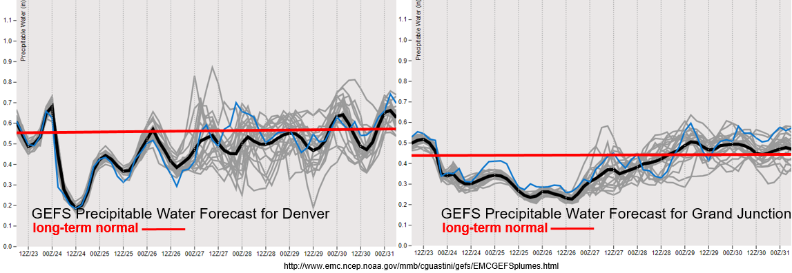
Below the GEFS Precipitable Water forecasts for Denver (left) and Grand Junction (right) show dry air filling in very quickly after the current system passes. This will allow temperatures to rebound tomorrow into the weekend with only an isolated threat for PM thunderstorms over the higher terrains. On Memorial Day, PW rebounds to near normal values, which should cause the uptick in storm activity. Event #1 looks to be warmer than the last two troughs, so snow will likely only occur on Tuesday over the mountains due to the passage of the cold front. Near normal (black line vs red line), PW is expected through the end of the week, though some spread is noted. This should keep scattered showers and thunderstorms in the forecast for the mountains, but widespread rainfall is not forecast.
Snowpack:
Cold air continues to reside over the state, which has stopped the melt out of the snowpack this week. Most gages have retreated from the Action Stage and snowfall has likely increased the SWE. At the current date, we are 159% of normal snowpack statewide, which is slightly inflated due to the late melt out. While there will be some heating this weekend, there won’t be enough consecutive days of heating to cause any serious melting. After Event #1, the amplified trough/ridge pattern seems to slow down. With more seasonable temperatures and an increasing ridge or zonal pattern forecast over the area, melting should increase by the end of next week. At this time, there is No Apparent Threat due to the drop off in gages this week.
Event #1: Sunday (5/26) – Tuesday (5/28)
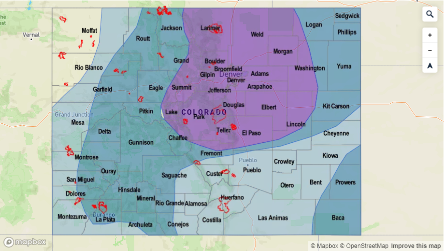
No Apparent Threat for widespread rainfall Monday and Tuesday as the next trough moves across the state.
Sunday afternoon, a shortwave trough is noted in the GFS over the eastern plains that is semi associated with the approaching trough. Should this occur in an area with higher dew points (the dry line in Colorado), there is a chance for isolated severe weather over the southeast corner of the state. Large hail and strong winds would be the main threat with local, heavy rainfall possible. Monday, moisture, mid-level ascent and the left exit region of the jet should return widespread showers and thunderstorms to the forecast. A cold front is forecast to drop through the state on Monday evening, which could cause severe weather over the Northwest Plains. This will be watched closely, although there is low confidence this far out. Showers continue Tuesday favoring the Front Range for the highest accumulations due to post-frontal upslope flow. With PW values near climatology, widespread flooding is not forecast. It may be possible for some local heavy rainfall over the adjacent and eastern plains, so please tune back into the FTO on Monday.


