Issue Date: Thursday, May 23rd, 2019
Issue Time: 9:15AM MDT
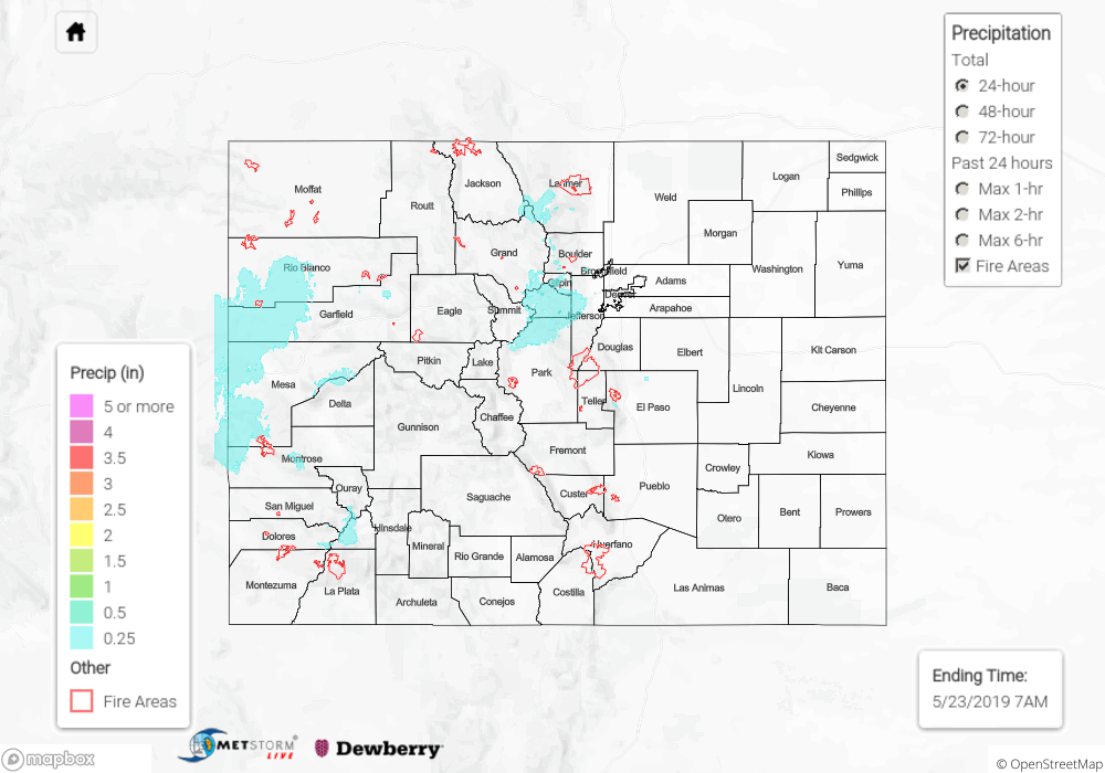
Summary:
There was a break in the rainfall for eastern Colorado between the two troughs on Wednesday. Residual moisture and upslope flow combined for some light shower activity over the Front Range. SNOTEL indicating totals were up to 0.75 inches along the Divide in Park County where 4-6 inches of snow were recorded. Elsewhere, totals were between 0.1 and 0.3 inches with 2 inches of snow reported at Rabbit Ears Pass. The deepening system over the Desert Southwest helped initiate scattered storms over western Colorado in two distinct waves. One occurred yesterday afternoon into the evening, and the other began early this morning as the upper jet moved into the region. Hail (0.25 inches) and gusts (45 mph) were reported with some stronger afternoon storms over the lower, western valleys. Total precipitation this morning was measured at 0.5 inches in western Garfield County and over NE Montezuma County. Elsewhere, totals along the western border and western high terrains were between 0.1 and 0.25 inches. Flooding was not reported.
To see precipitation totals from Wednesday in your neighborhood, scroll down to the State Precipitation Map below.
Click Here For Map Overview