Issue Date: Wednesday, May 22nd, 2019
Issue Time: 9:15AM MDT
Summary:
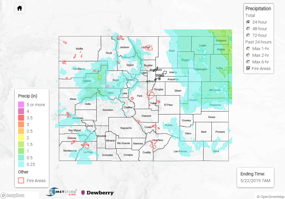
Another cold one overnight. Low temperatures dropped to freezing over the lower elevations of the eastern plains and Northwest Slope. The highest temperature yesterday was over Grand Junction where the 60°F mark was recorded. Elsewhere, temperatures were quite a bit below average for the end of May. Ongoing showers were present over the eastern plains in the deformation zone of the low. The heaviest 24-hour totals were recorded over the Northeast Plains. Radar estimations indicate 24-hour totals up to 1.5 inches with more general totals between 0.5 and 1 inch. Most all precipitation fell as snow over the Central and Northern Mountains with radar indicating heavy precipitation over Garfield County. Not many reports in this morning, but Avon received 2.3 inches. Heavy snow also fell in the San Juan Mountains with the snow level dropping to 7.5K feet. In Rockland, CO there was a report this morning with 8.1 inches falling overnight. Flooding was not reported.
To see precipitation totals from Tuesday, scroll down to the State Precipitation Map below.
Click Here For Map Overview