Issue Date: Monday, May 20th, 2019
Issue Time: 1:10PM MDT
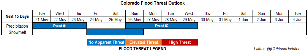
Valid Dates: 5/21 – 6/4
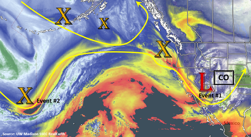
Very cold and unsettled weather to start the week. The low pressure system located to our west will continue to move into southeast Colorado this evening, which should keep widespread showers and snowfall going through Tuesday afternoon and evening (Event #1 pt1). Heaviest precipitation amounts are expected to be over the northeast quadrant of Colorado with snow overnight along the Palmer Ridge. After the low moves to our east on Tuesday, a second vorticity maximum drops south and returns southwesterly flow into the area (Event #1 pt2). So there will be brief pause in precipitation before this next system moves in on Wednesday and Thursday. As with the last systems, precipitation will start over western Colorado and move eastward on Wednesday and Thursday. Temperatures aren’t quite as cold either with this next wave, so snow should be limited to the highest terrains. On Thursday afternoon, severe weather may be possible over the eastern plains as models indicate a dry line setting up over the Southeast Plains.
The next system (Event #2) occurs as another vorticity maximum makes its way around the omega block seen in the water vapor imagery below. This will form another trough to the west that will affect the state at the beginning of next week. Models indicate an uptick in moisture beginning on Sunday evening and lasting through Wednesday. The best chance for widespread rainfall will be on Monday and Tuesday as the low traverses north of Colorado.
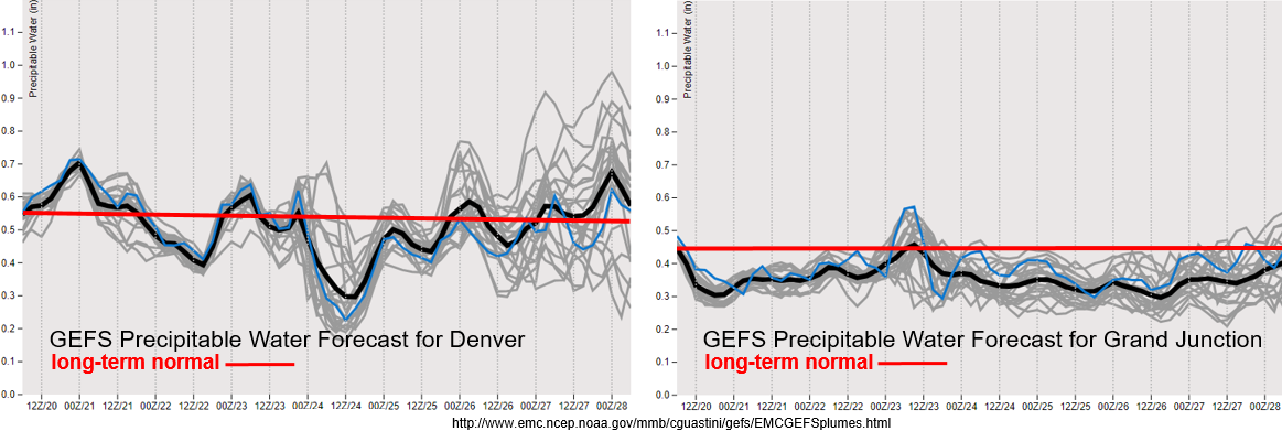
Below is the GEFS Precipitable Water forecasts for Denver (left) and Grand Junction (right). PW remains below climatology (0.45 inches) for the next week over western Colorado, so expect storms and showers to continue to be high-based. This means less rainfall making it to the surface with some gusty winds possible under the stronger storms. For Denver, after Tuesday you can start to see a slight downtick in moisture until Event #1 pt2 comes into play. Overall, there is no heavy rainfall threat for Event #1. For Event #2, the GEFS shows large uncertainty in PW over eastern Colorado. This is common a week out, but at this time there is No Apparent Flood threat for Event #2. The PW anomaly will continued to be monitored closely with updates added to Thursday’s FTO.
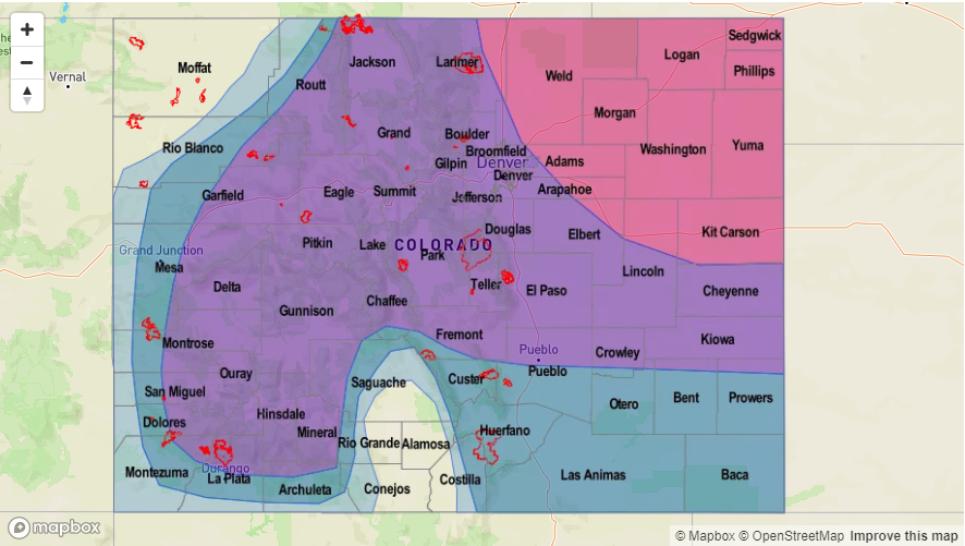
Cold air really put a cork in the melt out of the snowpack the last couple of days. With colder air arriving tonight and the chilly, unsettled atmospheric pattern in place, not expecting much melting the next week or so. There is a warm up to more climatological values at the end of this week, so some melting during the day may cause small rivers to start to rise. However, melting will be limited with overnight lows still hovering around freezing. There is no threat of riverine flooding at this time.
Event #1: Tuesday (5/21) – Thursday (5/23)
No Apparent Threat as ongoing showers and snow are forecast the next couple of days.
Ongoing showers and snow are expected tonight into tomorrow associated with the low over Nevada/Utah. Tomorrow, the low should be located over the southeast plains near the border and move toward the northeast throughout the day. This should continue rain and snow through the afternoon hours over the northeast quadrant of the state with the wrap around precipitation. A lull in precipitation is likely until the next trough arrives on Wednesday though some storms will likely pop up over the mountains tomorrow afternoon. Not too much low level moisture associated with this next system, and it looks to be a bit warmer, so snow should be confined to the highest terrains. On Thursday, models indicate a dry line setting up over the eastern plains. This could bring some severe weather to the area; however, the exact placement of the dry line is hard to nail down this far out. Possible threats include large hail, strong winds and a possible tornado. With PW values well below the 1 inch mark, flooding is not expected.

Event #2: Sunday (5/26) – Wednesday (5/29)
No Apparent Threat as unsettled weather continues with another trough to the west.
After a warm up over the weekend, storms return to the forecast at the beginning of next week. Expecting this system to mostly cause accumulation in the mountains, though some heavier rain and severe weather could be possible over the adjacent plains during the afternoon and evening hours if timing lines up. Temperatures continue to look to be a lot warmer with this system (relative to the current one), so snow should be confined to the highest terrains. The jets pulls the system to the northeast fairly quickly, so widespread flooding is not anticipated. As for the daily threat there is still a lot of spread in PW from the models, but at this time we will forecast no flood threat.