Issue Date: 6/17/2015
Issue Time: 10:16 AM
A LOW FLOOD THREAT IS FORECAST FOR PORTIONS OF THE FRONT RANGE, URBAN CORRIDOR, PALMER RIDGE, NORTHEAST PLAINS, SOUTHEAST PLAINS, AND RATON RIDGE.
LOW-TO-MODERATE FLOOD THREATS CONTINUE FOR PORTIONS OF THE CACHE LA POUDRE, SOUTH PLATTE, AND ARKANSAS RIVERS.
Finally, the atmosphere is beginning to dry out as weak, upper-level ridging builds across Colorado and the Southwest US. This will have an impact on overall storm coverage as the downturn that began yesterday continues today. That is not to say that it will be all sunshine; there will be isolated showers and thunderstorms this afternoon/evening that develop over the higher terrain and move east-southeastward. Those storms that move/develop over the Urban Corridor, Palmer Ridge, and the Northeast/Southeast Plains will have access to sufficient moisture and instability to produce locally heavy rainfall. With the moisture and instability available, a few storms will become strong-to-severe, capable of producing large hail (greater than 1 inch), strong winds (gusts up to 60 mph), and an isolated tornado.
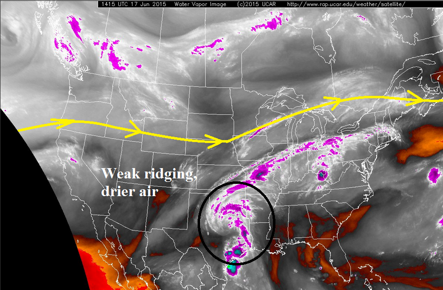
For areas to the west, ridging aloft and drier air will limit thunderstorm potential, relegating most of the activity to the higher terrain of the Continental Divide and San Juan Mountains. Heavy rainfall is not a concern over these areas, as rain rates will generally be in the 0.2-0.4 inches/hour range, with lighter rates expected out of weaker showers.
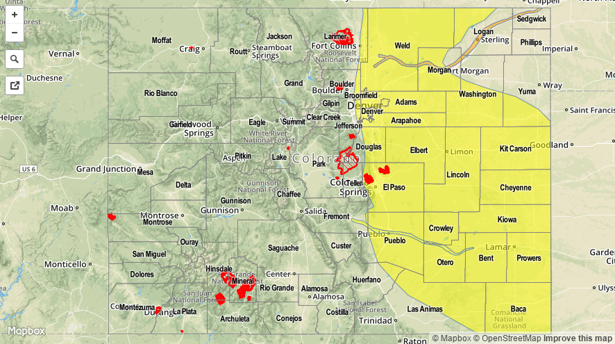
Today’s Flood Threat Map
For more information on today’s flood threat, see the map below (hover over threat areas for more details). For Zone-Specific forecasts, jump below the map.

Zone-Specific Forecasts
Front Range, Southeast Mountains, Urban Corridor, Palmer Ridge, Southeast Plains, Northeast Plains, and Raton Ridge:
Isolated showers and thunderstorms are expected this afternoon and evening, and a couple will become strong-to-severe. Locally heavy rainfall is still a concern for the Urban Corridor, Palmer Ridge, Northeast Plains, and Southeast Plains regions where the best moisture and instability will reside.
Maximum rain rates vary, so check out the following breakdown:
Front Range, Southeast Mountains, and Raton Ridge: 0.5-0.9 inches/hour
Urban Corridor, Palmer Ridge, Northeast Plains, and Southeast Plains: 1.4-2.0 inches/hour
Timing: 1 PM – 11 PM, with a few showers and thunderstorms continuing over the Palmer Ridge and plains regions until Midnight – 1 AM before diminishing/exiting the state.
Northern Mountains, Northwest Slope, Central Mountains, Grand Valley, San Luis Valley, Southwest Slope, and San Juan Mountains:
Warmer and drier, especially for the lower elevations of the Grand Valley, San Luis Valley, Northwest Slope, and Southwest Slope regions. Isolated showers and weak thunderstorms will mainly stay confined over the higher terrain of the Northern Mountains, Central Mountains, and San Juan Mountains where orographic effects can work against the upper-level ridging. Storms will drift east-southeast with time, so a few lower elevations will likely see a few raindrops downstream of the aforementioned mountains.
Timing: Noon – 8 PM