Issue Date: Monday, May 13th, 2019
Issue Time: 11:30PM MDT
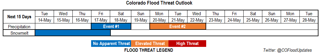
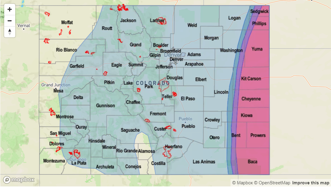
Valid Dates: 5/14 – 5/28
Cool start to the month of May across the state with the active pattern. Precipitation totals have also been above average for the higher terrains. The last weather system temporarily stopped the spring melting and added to the already high snowpack with the Central, Southeast and San Juan Mountains receiving the bulk of the snow accumulation. See the Upper Rio Grande Basin’s SWE (Snow Water Equivalent) below. With above average temperatures expected at the beginning of this week, we should start to see the melting of the snowpack pick back up at the higher elevations. At this time, flooding outside of minor flooding of small streams, is not expected.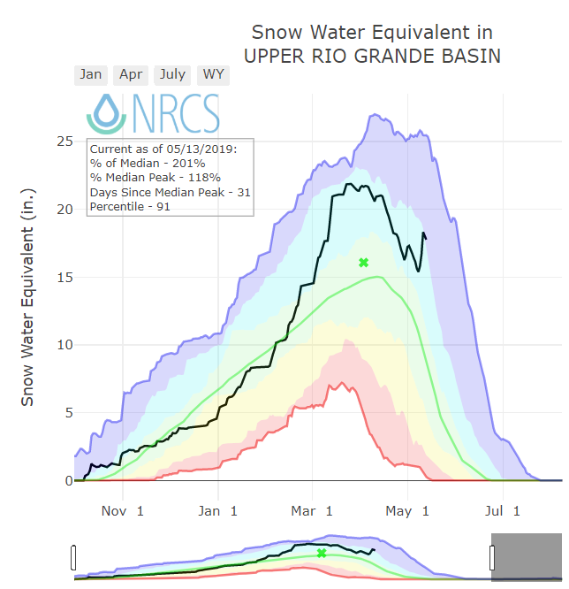
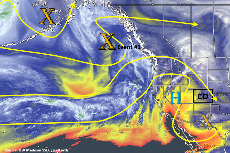
Below is the SSEC RealEarth water vapor imagery from UW Madison, which shows a very active pattern lining up over the North Pacific. Currently, there is cutoff vorticity max over Texas and New Mexico mentioned in the last FTO. This should stay well south of the state as the high pressure begins to build in from the west. With residual moisture under the ridge, weak thunderstorm activity over the higher terrains is possible each afternoon with the diurnal heating pattern. Event #1 begins as the two vorticity maximums combine (marked X’s in the North Pacific) and a large trough moves in over the west coast and pushes east. Flow aloft will switch to southwesterly on Thursday, which should pull in drier air seen in the image below and limit precipitation chances. Higher moisture is expected on Friday as the ridge slides east, and a front on Saturday should help return low level moisture to the plains. This is expected cause an uptick in thunderstorm activity.
A lull in the pattern occurs Sunday into Monday before the next trough moves in from the west coast (Event #2; not marked above). The GFS is showing a trough west of Colorado at the beginning of next week, which could bring widespread rainfall to western Colorado. While, PW values aren’t looking too impressive at this time, multiple rounds of rain and a melting snowpack could cause some flooding issues. Still quite a bit of time for the details of this system to develop, but there is an Elevated Threat issued for this FTO.
Event #1: Friday (5/17) – Saturday (5/18)
No Apparent Threat as a trough moves eastward from the coast bringing favorable dynamics to area for severe thunderstorms.
Moisture will start to increase towards the end of the week as the trough moves eastward and sits west of Colorado. This will increase the chances of rain and thunderstorms to start next weekend. Saturday, models are showing a cold front drop through the plains, which may increase low level moisture. The GEFS moisture plumes are also indicating an increase in PW values out east. With plentiful lift and dynamics during the afternoon, paired with the moisture return, severe thunderstorms may be possible on Saturday over eastern Colorado. Activity Saturday night is also possible over the eastern plains if upper dynamics align properly. Mostly this would be isolated and associated with an overnight MCS in a boarding state. This could cause some very heavy rainfall totals near the Colorado/Kansas/Nebraska borders should activity spill back to the west. Please tune back in on Thursday for an update as the No Apparent Threat may be upgrade for Saturday.

Event #2: Monday (5/20) – Wednesday (5/22)
Elevated Threat as a slow moving trough sits to the west of Colorado next week.
Again, lacking confidence in the details of this next pattern, but widespread precipitation may be possible for western Colorado at the beginning of next week if the nearly stationary trough plays out. With snowpack high and temperatures rising, there could be a threat for some minor flooding. At this time, there is an Elevated Flood threat. However, if low level moisture is lacking and rainfall is gradual enough, flooding may not be an issue. Please tune back into the FTO on Thursday for evolving details.