Issue Date: Thursday, May 9th, 2019
Issue Time: 12:15PM MDT
Valid Dates: 5/10 – 5/24
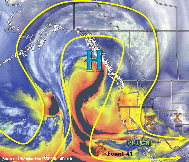
We start this FTO with the tail end of Event #1 from Monday’s FTO. Currently, a trough is exiting eastern Colorado with a break before the next wave moves in from AZ/UT/NV. This means flow aloft will turn to southwesterly to westerly on Friday. A plume of moisture, marked in the water vapor imagery below, will be pulled into southern Colorado. This will help fuel some snowfall and rain (lower elevations) over southern Colorado along the CO/NM border tonight into Friday morning. Expecting showers to continue tomorrow afternoon before the trough pulls westward and digs south creating a cutoff upper level low off the coast of CA.

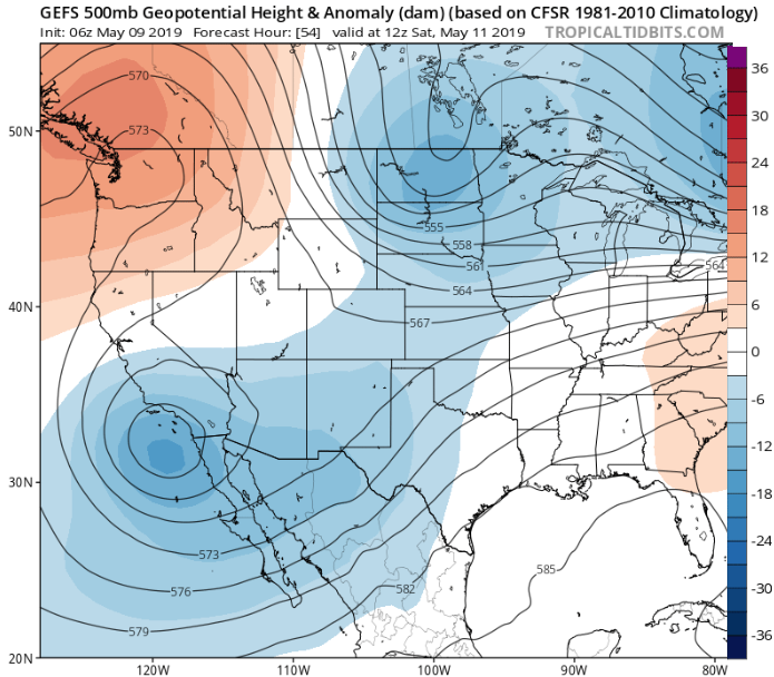
Below is the 500mb geopotential height anomaly from the GEFS (Global Ensemble Forecast System) on Saturday morning. It very nicely illustrates the low becoming cutoff from the main, westerly flow. Once the system is cutoff, it moves south and slowly wanders east (Saturday-Tuesday). It should stay far enough south that it won’t affect the state. On Friday, high pressure starts to build over the state and a weak cold front gives the winds more of a northerly component on Saturday afternoon. This should prevent widespread showers as only minimal moisture remains trapped under the building ridge. Expect scattered storms over the San Juan Mountains with limited rainfall over the other high elevations. With high pressure to the north and low pressure to the south by Sunday, a nice a rex blocking pattern should keep the weather calm into next week. Warm temperatures will also be back in the forecast, so expecting widespread melting of the snowpack between the two systems. High temperatures over the lower elevations will start climbing towards 70°F by Sunday, and they be well into the 70°Fs on Monday and Tuesday.
Event #2 begins sometime between Wednesday and Thursday of next week. The next trough slides over the west coast and pushes the ridge eastward. Details of this event are still a little bit out, but right now the best moisture and dynamics don’t move into the state until Thursday or Friday. At this time there is No Apparent Threat; however, some severe weather may be likely towards the end of next week.
Event #1: Friday (5/10) – Saturday (5/11)
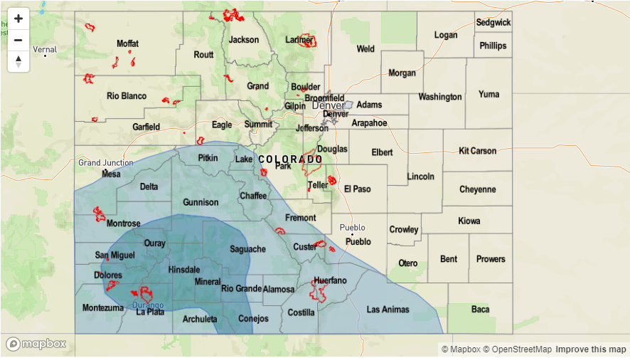
No Apparent Threat as the cutoff low moves south and westward of the state. The current wave over UT/AZ/NV will help provide lift and moisture for scattered storms across the southern border of the state into Friday morning.
With the next wave moving into Colorado this afternoon and tonight, the chances for rainfall will be greatest over the southern border. Light showers and snow accumulation are likely over these higher terrains by tomorrow morning. As the ridge begins to build over the state, some residual moisture on Saturday may help initiate some storms over the San Juan Mountains. Without a ton of moisture under the building ridge, totals should be much less than the last couple of days. Highest totals are forecast over the western facing slopes in the San Juan Mountains with lighter totals over the Southeast Mountains and Raton Ridge. Flooding is not expected.
Event #2: Wednesday (5/15) – Saturday (5/18)
No Apparent Threat as the next trough moves over the west coast and pushes the ridge east.
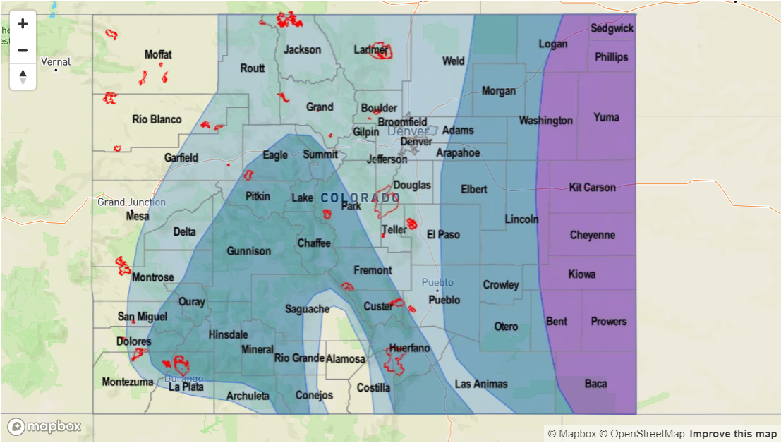
Not a lot of confidence in the details of this next pattern, but storms look to return to the forecast towards mid/end of next week. Best dynamics and moisture will likely arrive when a cold front drops south. Right now the GFS is predicting this sometime on Wednesday afternoon. This would allow for some moisture to return to the lower levels and provide some favorable dynamics for severe weather. Tune back into the FTO on Monday for evolving details. Due to the low confidence, please view the map below with caution. At this time, there is No Apparent Flood Threat.


