Issue Date: Wednesday, September 12th, 2018
Issue Time: 09:05AM MDT
— Flooding is NOT expected today
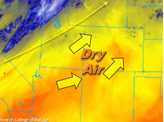
Southwest flow aloft will continue today, which will produce another day of near-record high temperatures. The warm, arid air mass from the southwest has scoured out a lot of the remaining moisture the last few days, so skies are forecast to be mostly clear this afternoon. This will also nearly zero out the chances for rainfall today though some isolated, light cloud cover may be possible. As expected, above average temperatures and low relative humidity values increase fire danger. With stronger winds aloft mixing down to the surface, critical fire weather is forecast for northwest and west-central Colorado. A Red Flag Warning is in place from 11AM this morning to 8PM this evening with surface winds forecast to be between 20 and 30 mph. Gusts up to 40 mph are also possible. As anticipated, there is no flood threat today.
Today’s Flood Threat Map
For more information on today’s flood threat, see the map below. For Zone-Specific forecasts, scroll below the map.
Zone-Specific Forecasts:
Southeast Plains, Palmer Ridge, Urban Corridor, Northeast Plains, Raton Ridge, Southeast Mountains, Front Range, San Juan Mountains, San Luis Valley:
Clear skies and above average temperatures will put us near (or above) records again today. High temperatures over the lower elevations are forecast to be 90F+ with higher elevations also increasing a tick or two from yesterday. Isolated, light cloud cover is possible over the higher terrains this afternoon as well as over the Palmer and Raton Ridges though rainfall is not anticipated. Winds between 15-20 mph are possible over the far eastern plains, which should lead to enhanced fire weather over this region. At this time, Red Flag Warning criteria will not be met. There should be plentiful sunshine statewide, so be sure to get out and enjoy the weather.
Grand Valley, Central Mountains, Northern Mountains, Southwest Slope, Northwest Slope:
Stronger winds will mix down to the surface again today. Paired with high temperatures and relative humidity values in the teens to single digits, critical fire weather is forecast once again. Surface winds today will likely be between 20 and 30 mph with gust up to 40mph. Please use extreme caution with any activity that can produce a spark. A Red Flag Warning is in effect from 11AM to 8PM.