Issue Date: Monday, September 10th, 2018
Issue Time: 1:00 PM MDT
Valid Dates: 9/11 – 9/25
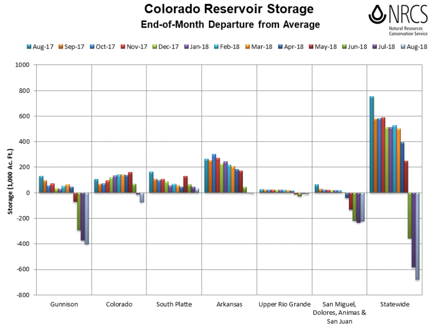
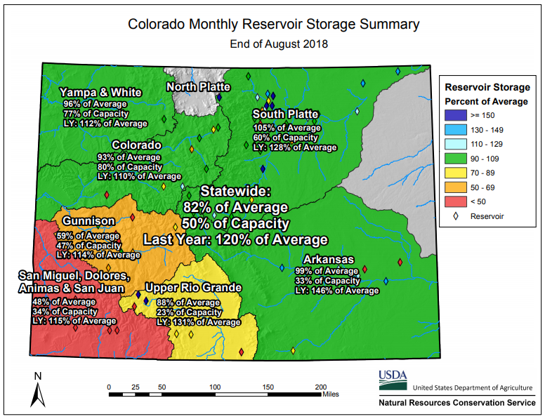
We’ve been monitoring the reservoir storage since the beginning of May since it was such a low snowpack season for the majority of the state. With a weak 2018 monsoon season over western Colorado as well, the southwest corner of the state is currently experiencing exceptional drought conditions with the majority of western Colorado (and the Southeast Mountains) undergoing extreme drought conditions. Below is the end-of-month departure from average (Aug 2017-Aug 2018) as well as a monthly reservoir storage summary for August. Compared to this time last year, statewide reservoir storage is 38% lower. Currently, statewide reservoir storage average is at 82%, which is about 700,000 acre feet below normal. The Blue Mesa Reservoir (Gunnison River Basin) has been in the news lately as it is at 37% of normal capacity. This is the lowest water level seen since 1987. Overall, still seeing below normal storage in the Gunnison and San Miguel/Dolores/Animas/San Juan basins. While there has been slight improvement in the latter basin, it is still about 50% of average. The Colorado and Upper Rio Grande basins are also slightly negative, which is contributing to the statewide deficit. The above average temperatures seen so far in September and warm forecast this week will likely continue to chip away at the storage.
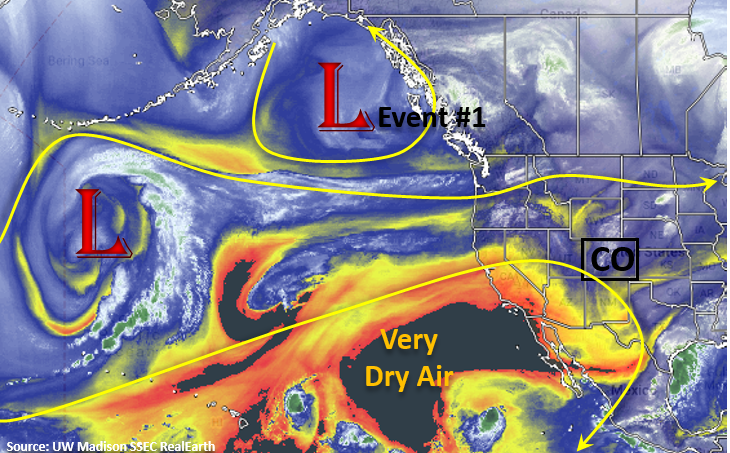
The forecast from Thursday’s FTO is still on track. Westerly upper-level flow begins today and will continue through tomorrow under a weak ridging pattern. This will continue to push the higher moisture to the east, though some residual moisture could produce some patchy showers over the higher terrains on Tuesday (Event #1). A shortwave will move through the state as well, which may help produce widespread, afternoon cloud cover over the high terrains. By Wednesday, upper-level flow will turn southwesterly as a positively tilted trough builds over the west coast. This will continue to entrain a very dry air mass from the southwest (AZ/NM) seen in the water vapor imagery below. So by Wednesday, southwesterly flow should mix out all the residual moisture under the ridge, so not expecting any measureable rainfall. Instead, forecasting plentiful sunshine and warmer temperatures through the start of this weekend.
By Wednesday, an upper-level jet oriented southwest to northeast will move into the northwest corner and west-central portion of the state. With warmer temperatures and low relative humidity in place, stronger surface winds will likely produce some critical fire weather over the state focused over this region. Strong winds may also mix down to the surface over the eastern plains during this period, which could cause some fire weather issues here as well. Please tune back into the FTB on Wednesday and Thursday for more details as a Red Flag Warning will likely be necessary. The GFS is still showing the west coast trough moving through the state at the end of next weekend (Event #2), so their will likely be some moisture return with the shortwave and an uptick in afternoon thunderstorm activity. At this time there is No Apparent Threat for flooding during this FTO.
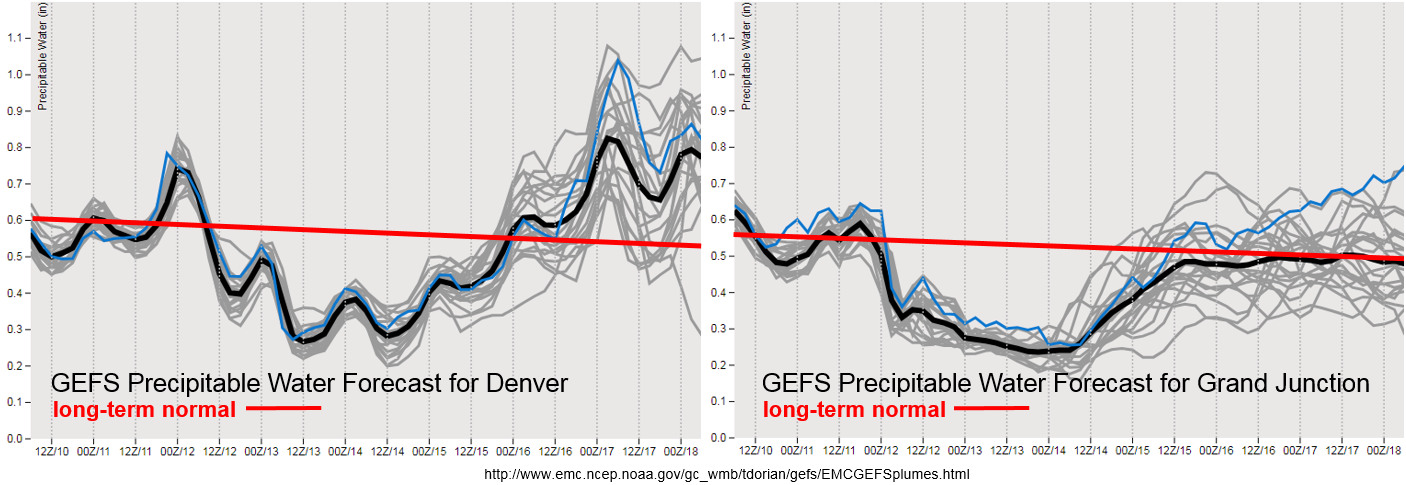
The diurnal low-level moisture cycle shows high enough values on Tuesday for some possible showers and weak thunderstorms over the high terrains. They will likely be focused over the southern Front Range and Southeast Mountains, though a storm or two could form over the San Juan Mountains. Over the adjacent plains, a couple storms may survive and produce some light rainfall over the Palmer Ridge and Northeast Plains. After Wednesday, PW values drop off quite a bit statewide. This should give us a break from rainfall until the trough moves through at the end of next weekend. While moisture return looks weak over western Colorado this weekend, there is an upward trend in PW values over eastern Colorado. While it will likely not reach 1 inch (and cause flooding issues), above average seasonal PW values will likely cause an uptick in storm activity over the higher terrains. Steering winds are forecast to be quick enough that burn scar flash flooding should be avoided (at this time). Please tune back into Thursday’s FTO as models will likely come into better agreement with timing of the trough passage and magnitude/timing of the moisture return.
Below we describe the two identified precipitation event of this FTO in more detail.
Event #1: Tuesday (9/10)
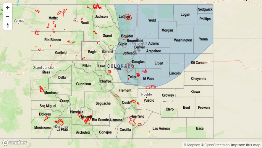
No Apparent Threat as residual moisture under the ridge produces one more day of isolated showers and weak thunderstorms over the mountains and Northeast Plains.
Storm activity should be similar or less than this afternoon as dry air continues to be entrained over the state. None the less, some isolated showers are possible over the higher terrains with residual moisture under the ridge. The passage of an afternoon shortwave will also help to increase cloud cover over the mountains and adjacent plains tomorrow afternoon. Max 1-hour rain rates should stay below flood threat criteria for recent burn areas with higher rainfall totals north of the burn scars. With temperatures near 90F at the lower elevations and low dew point values, rainfall over the I-25 corridor is not likely. If the storms are able to stay together as they move into the Northeast Plains and eastern Palmer Ridge regions (help from the shortwave), dew points in the high 40Fs may help produce some light rain.
Event #2: Sunday (9/16) – Tuesday (9/18)
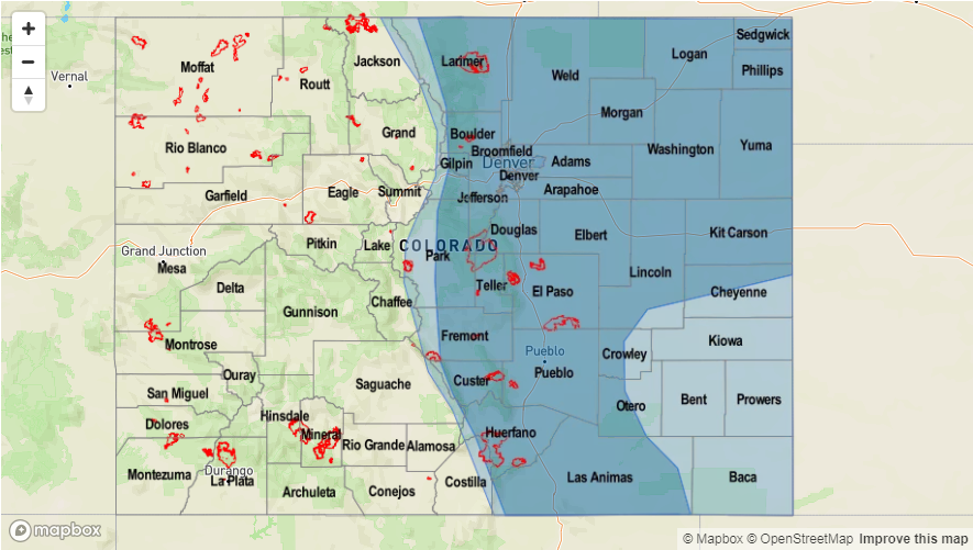
No Apparent Threat as a second trough moves eastward from a nearly stationary position this week and brings a boost to low-level moisture.
A little better confidence that a couple shortwaves will move through northern Colorado during this period. A boost to low-level moisture will also be likely though values should stay under 1 inch. Not much low-level moisture return for western Colorado, so there is a better chance for rainfall over the Front Range, Southeast Mountains, Palmer Ridge and Northeast Plains. Still quite a bit of uncertainty as to how much moisture will return for storm coverage and intensity, so at this time we’ll just say there should be an uptick in afternoon shower and thunderstorm activity. Please tune back to Thursday’s FTO for more information and changes to this forecast.

