Issue Date: Thursday, August 31st, 2018
Issue Time: 09:40AM MDT
— Flooding is NOT expected today
Across much of Colorado, August will come to an end with seasonably warm temperatures and a chance for afternoon thunderstorms, offering a slight break from fire weather potential. The upper-level high over the southwestern states that has continually brought dry, hot weather to the state throughout the week is finally beginning to move further east. In its wake, a shake-up in the usual late-summer pattern is expected: first, with a larger chance for shower and thunderstorm activity as a shortwave moves in to replace the withdrawing upper-level high, and then with much cooler temperatures forecast for overnight and tomorrow.
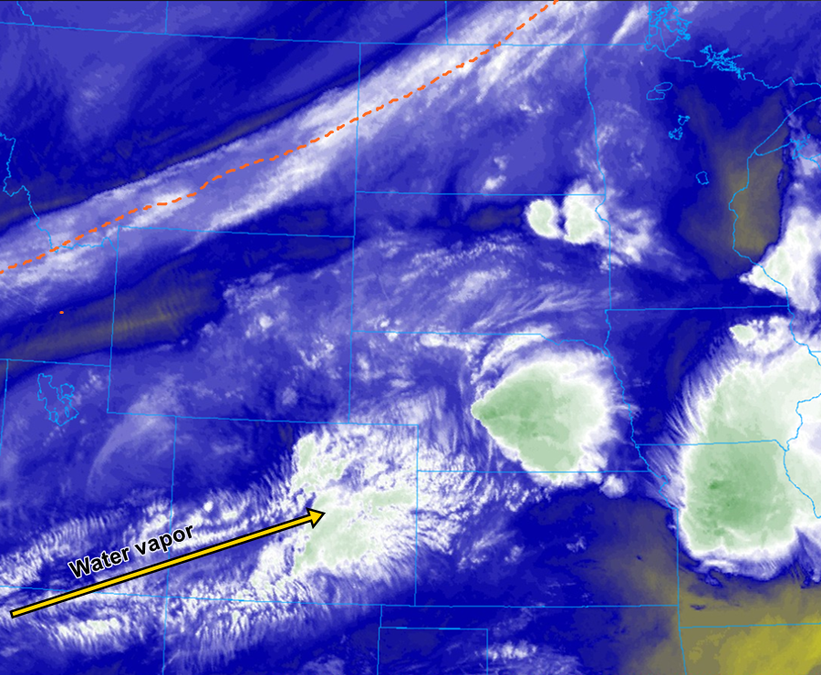
Above the surface, higher relative humidity values than in days previous may help aid thunderstorm development this afternoon, as shown in the mid-level water vapor imagery above. Low-level moisture, however, will still be somewhat lacking. Wind gusts, particularly in the outflow of thunderstorms, are expected but not predicted to be widespread or strong enough to warrant any critical fire weather danger for this afternoon and evening. The aforementioned thunderstorm development is not forecast to produce any flooding today.
Today’s Flood Threat Map
For more information on today’s flood threat, see the map below. For Zone-Specific forecasts, scroll below the map.
Zone-Specific Forecasts:
Northeast Plains, Southeast Plains, Southeast Mountains, Palmer Ridge, Raton Ridge, Urban Corridor, and Front Range:
Temperatures again into the upper 80s/lower 90s during the afternoon, as morning cloud cover gives way to sunny skies into the early afternoon. By 2pm, expect towering cumulus clouds to form, first over the Front Range and Southeast Mountains, and then continue along into the eastern plains regions. Thunderstorm activity will be widespread across the eastern half of the state, where surface dew points just into the low 50s will help bring ample rainfall to the surface. Maximum hourly rainfall rates of around 0.25 inches may occur under stronger storms, particularly along the Urban Corridor and Palmer Ridge, but no flooding is anticipated today.
Primetime: 3PM – 9PM
Grand Valley, Northwest Slope, Northern Mountains, Central Mountains, Southwest Slope, San Juan Mountains, and San Luis Valley:
Unlike areas of the state further east, thunderstorm potential will be hindered in these regions due in large part to less humid air. Mostly sunny conditions will reign today, with hot afternoon temperatures and relatively calm winds compared to earlier this week. Fire weather hazard is thus much lower today, but caution is still stressed using open flames outdoors. A stray afternoon thunderstorm cannot be ruled out completely, notably for the Northern and Central Mountains, but rainfall rates are expected to top off between 0.05 and 0.1 inches per hour. No fire weather or flood threat is forecast for today.