Issue Date: Wednesday, August 29th, 2018
Issue Time: 08:35AM MDT
— Flooding is NOT expected today
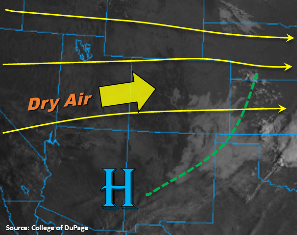
High clouds to start the morning over the Southeast Plains with morning temperatures rebounding to more seasonal values. Expecting high temperatures to be at or a couple degrees above normal today. The high clouds are expected to continue to mix out with the daytime heating over the next couple of hours with sunny skies forecast for the rest of the day. Today, flow aloft will become a bit more southwesterly, which will pull in the cloud free, dry air from Utah and Arizona. This also means good visibility with another break from the smoke. Subtropical moisture should remain south and east of our area with the placement of the 500mb high over AZ/NM.
The continued entrainment of dry air over western Colorado will nearly zero-out the chances for rainfall again, although high cloud cover is expected to increase into this afternoon and evening. There is a slight chance for some high-based showers over the San Juan Mountains near the Continental Divide, though virga is the more likely scenario. To the west, weak upslope flow will set up again this afternoon. With limited moisture under the ridge, storms are expected to be high-based and isolated in nature. The best chances for rainfall and cloud cover today will be near areas of extra convergence, so this will be along the Raton, Palmer and Cheyenne Ridges. The weaker showers and thunderstorms that are able to form will move eastward and disperse as the sun sets. Flooding is not expected today.
Today’s Flood Threat Map
For more information on today’s flood threat, see the map below. For Zone-Specific forecasts, scroll below the map.

Zone-Specific Forecasts:
Southeast Plains, Raton Ridge, Southeast Mountains, Front Range, Palmer Ridge, Urban Corridor, Northeast Plains:
High temperatures are expected to rebound this afternoon, so the pleasant, cooler temperatures were short-lived. The best chance for afternoon storms today are along the Cheyenne, Palmer and Raton Ridge (in that order). Limited low-level moisture is expected to produce high-based storms that are isolated in nature. Max 1-hour rain rates up to 0.5 inches (north) and 0.3 inches (south) are possible. As expected, flooding is not forecast today.
Primetime: 3PM – 9PM
Grand Valley, Central Mountains, San Juan Mountains, San Luis Valley, Southwest Slope, Northern Mountains, Northwest Slope:
Southwesterly winds aloft will continue to entrain dry air today, so there is an elevated fire risk once again though wind/relative humidity values won’t reach critical fire conditions. This west/southwest flow aloft also means another break from the smoke! Temperatures are expected to be at or a couple degrees above normal. Forecasting high clouds to increase this afternoon with an outside chance of an isolated shower over the eastern San Juan Mountains.
Primetime: 3PM – 7PM