Issue Date: Friday, June 12th, 2015
Issue Time: 9:10 AM MDT
Summary:
On Thursday, very moist conditions statewide promoted an incredibly active hydrometeorological day basically across the entire state. Morning showers and storms were ongoing across the Northwest Slope and Grand Valley. These storms increased in intensity and coverage as the day wore on. By early evening, almost everyone west of the Divide saw at least some rainfall. Most storms produced light to moderate rainfall amounts, in the 0.3 to 0.7 inch per hour range. However, several stronger storms produced rain rates over 1 inch per hour. The maximum observed 24-hour rain totals were as high as 1.5 inches. But chances are that there were likely higher amounts in some remote, non-measured locations. Numerous flood warnings and advisories were in place mainly over the San Juan mountains. A flooding report was received in Gunnison County, where an emergency manager noted a washed out road near Kebler Pass.
Meanwhile, areas east of the Divide had their own set of weather to experience. Thunderstorm activity began shortly after noon with initially light to moderate rainfall amounts. But as storms grew in scale and coverage, this rapidly changed with many heavy rain producing storms scattered all the way from the Wyoming border south and east through the Arkansas River valley. Highest 30-minute rainfall totals were in the 1.8 inch range (Larimer county) while highest 1-hour rainfall was around 2.2-2.4 inches. A few notable 24-hour rainfall amounts were:
- 3.92 inches in Elbert County
- 3.84 inches in Douglas County
- 3.47 inches in Denver County
- 3.34 inches at a USGS gauge in Las Animas County
As dry air was initially present over the Southeast Plains, early storms there were supercellular in nature. The result was some very large hail (up to 3 inches in far southeast Colorado!), and even a few tornado sightings in Baca County.
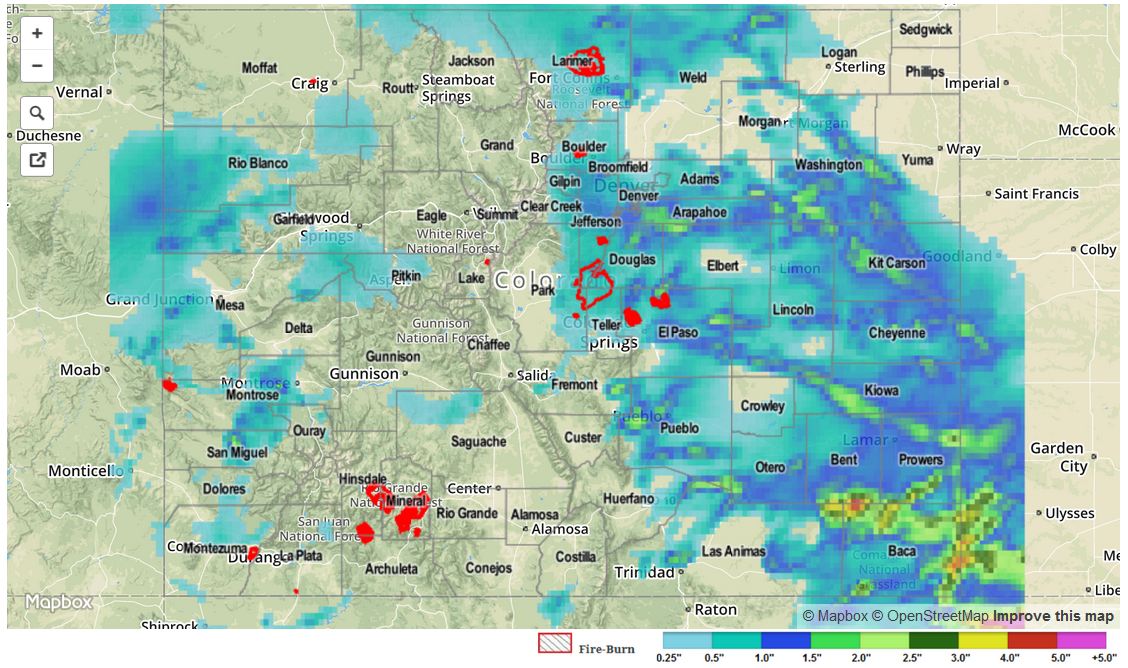
For estimated rainfall in your area, be sure to check out the rainfall map below.