Issue Date: Thursday, August 23rd, 2018
Issue Time: 12:15 PM MDT
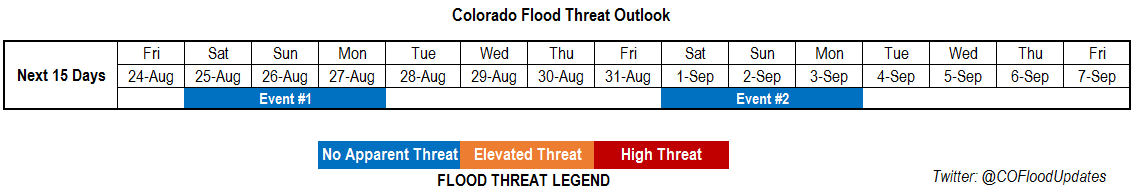
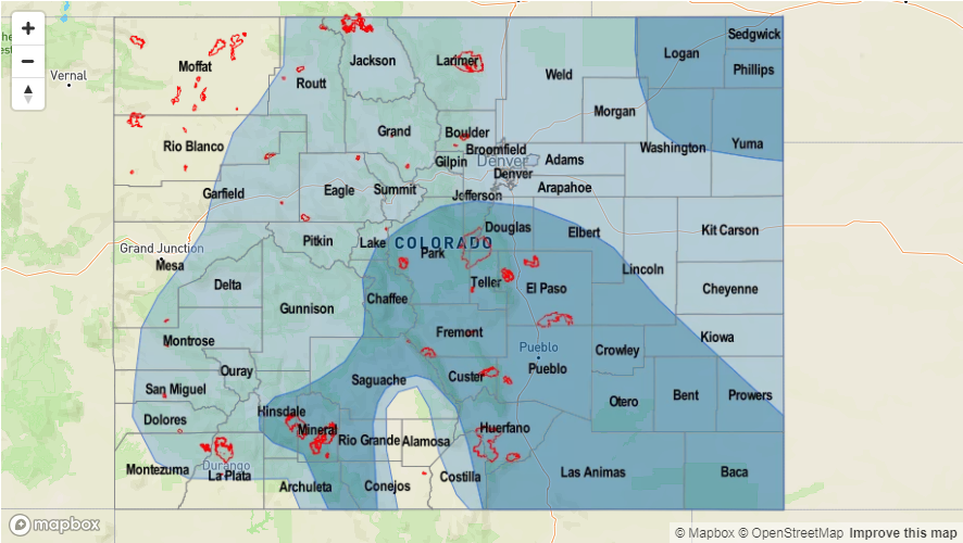
Valid Dates: 8/24 – 9/7
This next FTO period is expected to have on and off rainfall activity with an almost repetitive pattern of troughs dropping into the Pacific Northwest and then lifting to the northeast. There is very little movement in the subtropical high over the Pacific, which is leading to this recurring cycle. The troughs movement will produce east and west change in the ridge axis, which will bring on and off subtropical moisture into the state. Currently, the trough that brought our last monsoon moisture surge is passing over the northern border of Colorado. This is pulling in dry air behind it and promoting downsloping flow across the state. Subsidence and dry air entrainment will continue on Friday as the next trough starts to dig in over the northwest (Event #1).
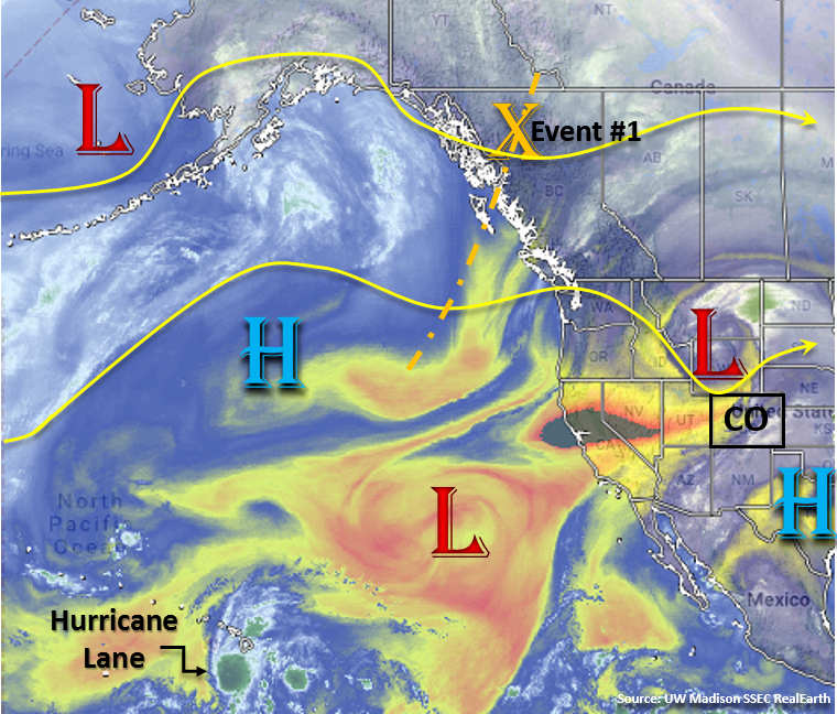
Starting Saturday, flow aloft will turn more to the southwest and the ridge axis will shift eastward. The center of the 500mb high shifts into eastern Texas, which allows subtropical moisture to return to eastern Colorado and the southwest corner of the state. This surge is not expected to be as strong as the last, but rain rates could still pose a threat to burn scars over this weekend and an uptick in shower activity. The pattern holds on Sunday, but the high pressure becomes a bit more elongated and shifts into the southeast US through Monday. Low-level moisture is expected to decrease with this movement, with the higher subtropical moisture shifting south and east of Colorado. Tuesday the trough begins its migration eastward, which may brush the northern border of Colorado and drop a weak cold front through the Northeast Plains. Behind the trough, more zonal flow aloft will promote drying and downslope flow through the rest of the week. Weak and isolated showers will still be possible over the higher terrains during the afternoon and evening hours.
Event #2 begins at the end of next week as another trough rounds the subtropical high over the Pacific and deepens over the west coast. Southwesterly flow is forecast to return to the state, but there is a lot of uncertainty as to where the center of the 500mb high will set up at this time and the strength of the trough. Both these details will determine the magnitude and location of the subtropical moisture return. Nonetheless, it looks like a potentially stormy pattern, or at least uptick in storm coverage, for the holiday weekend.
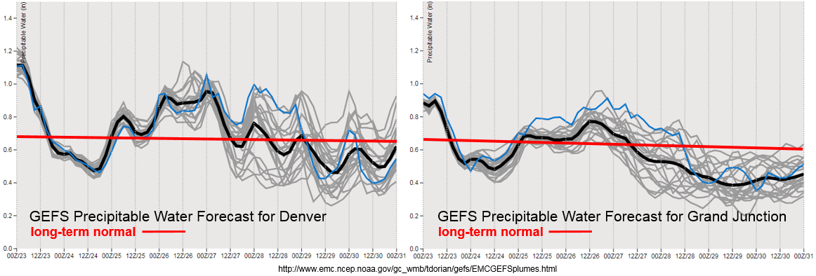
Some exceptionally dry air will work its way into Colorado with the westerly flow aloft over the next couple of days. PW values are expected to drop from the 90th percentile to the 10th percentile in about a 36 hour span. These very dry conditions are expected to create some critical fire weather, so please use caution with any open flames. The GEFS begins an upward trend in moisture towards the end of this week statewide with the next trough arrival. Moisture return further north over western Colorado is not expected to be as strong as this last surge, so storms that do form will likely produce gusty winds. Zonal flow at the beginning of next week is expected to decrease PW values once again, which should cause a downtick in afternoon thunderstorm activity. Below we describe the two identified precipitation event of this FTO in more detail.
Event #1: Saturday (8/25) – Monday (8/27)
No Apparent Threat as a trough digs south over the west coast and southwest flow aloft over CO pulls in a bit of subtropical moisture into the state.
Another, weaker monsoon moisture surge is likely this weekend. This should mostly affect eastern Colorado and the southwest corner of the state. Thunderstorms are expected over the northern portion of western Colorado, but will likely produce more gusty winds than rainfall. Shortwaves are forecast to move through each day, and if timed correctly, will help provide an uptick in thunderstorm coverage. Over the higher terrains, rain rates have the potential to cause problems for recent burn scars without much flooding expected elsewhere. Some severe thunderstorms are possible on Saturday over the eastern plains, but with decent storm motion and moderate dew points, flooding is not expected at this time. Sunday into Monday there will be a downtick in storm activity from west to east as the trough passes north of Colorado and downsloping flow begins.

Event #2: Saturday (9/1) – Monday (9/3)
No Apparent Threat as southwesterly flow returns with another troughing pattern over the west coast.
For Event #2 there is still a quite a bit that can change. With an almost repetitive pattern in place, another trough is expected to set up over the east coast at the end of next week. This should push the ridge axis eastward and return southwesterly flow aloft. At this time, it is unknown how much low-level moisture will be pulled northward into the state, but this pattern is typical for an uptick in storm development. Moisture will likely return to the west first and spread eastward from there. With it being a holiday weekend, it is best to be prepared though details are likely to change in Monday and Thursday’s FTO. Please tune back in then for the latest details and evolution of Event #2.