Issue Date: Thursday, August 23rd, 2018
Issue Time: 10:25 AM MDT
Summary:
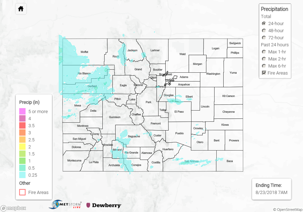
The surge of monsoon moisture that was forecast for yesterday did indeed arrive and make its mark across portions of the state. Portions of virtually every county in the state received some rain yesterday, but the vast majority of reports were for 0.1 inches or less. However, there were a handful of reliable reports of at least an inch of rainfall yesterday:
- Grand Valley (Mesa County): 1.30”
- Steamboat Springs 1W (Routt County): 1.26”
- Gunsight (Grand County): 1.24”
- Larkspur 7.1 ESE (Douglas County): 1.02”
- Great Divide (Moffat County): 1.01”
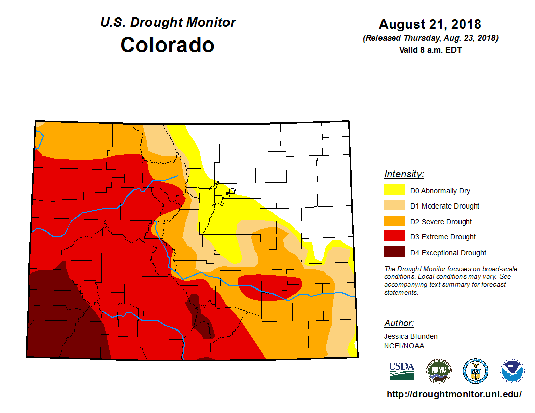
Notice that these locations spanned everywhere from the western slope to the north-central mountains to the plains near Colorado Springs. Some sub-severe hail was also reported with the Mesa and Garfield County storms, but no damage reports were received. After going much of the summer without any rain at all, the Grand Junction area finally received two days in a row of decent monsoon storms which cut their year-to-date rainfall deficit in half! Unfortunately, however, the southwestern 2/3rds of the state remains in deep drought (see Drought Monitor map below).
To see how much precipitation fell over your neighborhood yesterday, scroll down to the State Precipitation Map below.
Click Here For Map Overview

