Issue Date: Saturday, August 18th, 2018
Issue Time: 9:30 AM MDT
Summary:
A mid-level disturbance rotated across the state yesterday, triggering widespread showers and thunderstorms across Colorado yesterday. West of the Continental Divide, activity could be classified as garden-variety, producing light-to-moderate rainfall and gusty winds. East of the Continental Divide, however, high moisture values provided the fuel for strong thunderstorms that produced heavy rainfall. Reports of flash flooding and flash flooding-related issues are as follows:
-Highway 96 in Custer County between mile marker 8 and 8 was washed out due to flooding. Multiple cars washed off the road.
-Flooded roadway at Date Street and Siferd Boulevard in Colorado Springs
-Street flooding at the intersection of Ruskin and Shelley in Colorado Springs
-Flooding of I-25 between mile markers 120 and 122. Six cars were swept off the roadway.
-Multiple dirt roads washed out in Pueblo County
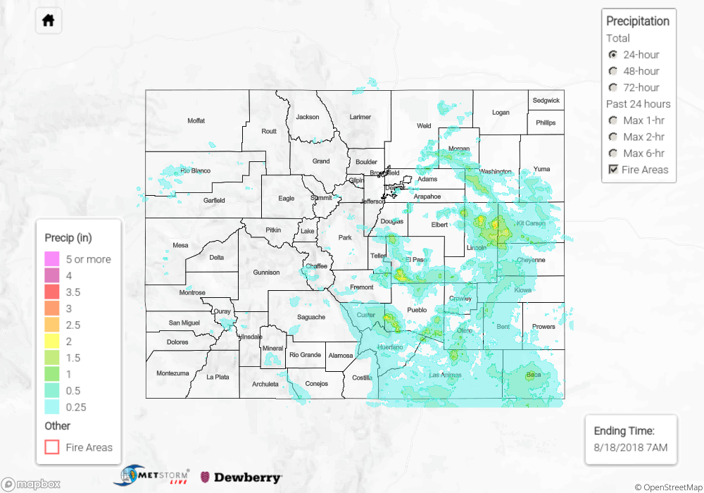
For a look at precipitation estimates in your area, please see the State Precipitation Map below.
Click Here For Map Overview
The map below shows radar-estimated, rainfall gage-adjusted Quantitative Precipitation Estimates (QPE) across Colorado. The map is updated daily during the operational season (May 1 – Sep 30) by 11AM. The following six layers are currently available: 24-hour, 48-hour and 72-hour total precipitation, as well as maximum 1-hour, 2-hour and 6-hour precipitation over the past 24 hour period (to estimate where flash flooding may have occurred). The 24-hour, 48-hour and 72-hour total precipitation contain bias corrections that are not disaggregated into the hourly estimates, so there will likely be some differences. The accumulation ending time is 7AM of the date shown in the bottom right corner. Also shown optionally are fire burn areas (post 2012), which are updated throughout the season to include new burn areas. The home button in the top left corner resets the map to the original zoom.