Issue Date: Friday, August 17th, 2018
Issue Time: 10:00 AM MDT
Summary:
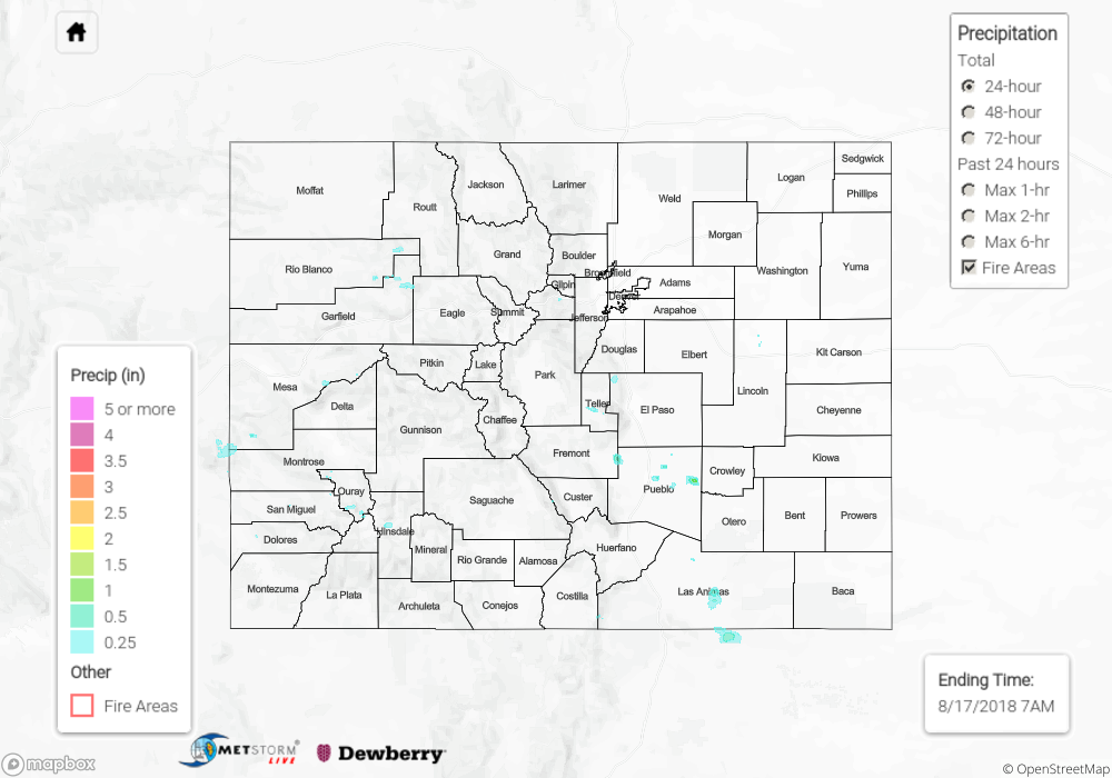
Another round of showers and thunderstorms fired over the southern high terrains on Thursday. Dry air continued to be entrained from the north, so not much action over the northern half of the state again. Totals were able to increase due to a slight upward tick in low-level moisture over western Colorado. A CoCoRaHS in Delta County reported 0.42 inches. Unfortunately, still no rain for Grand Junction. Pagosa Springs got 0.22 inches and its north, the Weminuche Creek SNOTEL station reported 0.5 inches. These were similar totals to stations over the western San Juans. A station in Del Norte reported 0.41 inches. The highest CoCoRaHS report for the day was in Pueblo, which reported 0.63 inches. Radar estimates indicate storms over the adjacent eastern plains produced rain rates just over 0.5 inches/hour.
Flooding was not reported on Thursday though there was an areal flood advisory and flash flood warning issued from the Pueblo office in the early evening. To see how much precipitation fell over your area, scroll down to the State Precipitation Map below.
Click Here For Map Overview