Issue Date: Friday, August 10th, 2018
Issue Time: 09:40 AM MDT
Summary:
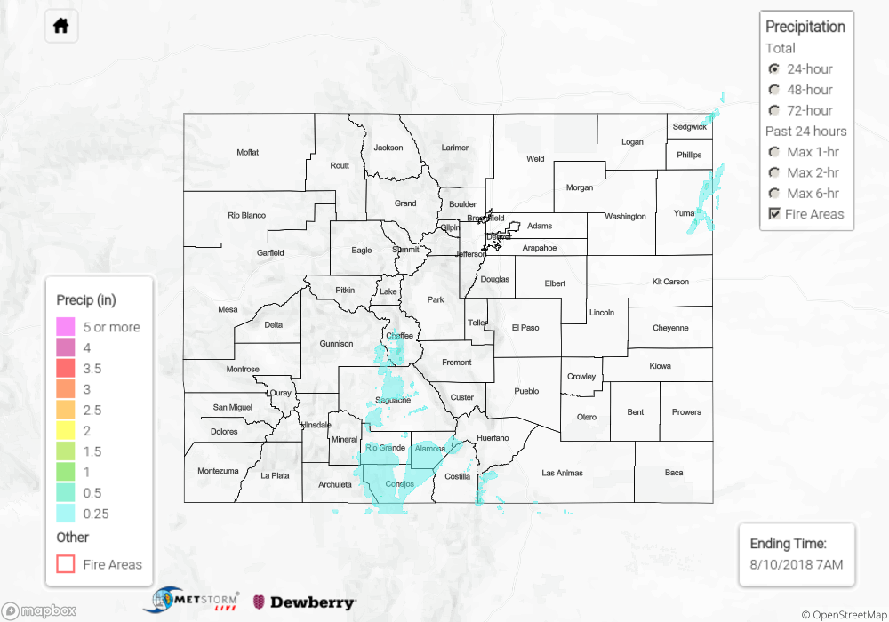
Northerly flow aloft with a slight easterly component kept convection on Thursday confined to the mountains. The SPM also shows the thunderstorms that formed early this morning over the Northeast Plains with a passing vorticity max. With subtropical moisture to the south, widespread flooding was not anticipated or realized. A westward shift in the main axis of convection brought some much needed rainfall to the eastern San Juan Mountains and southern Central Mountains. Storm motion was south yesterday, so after storms formed over Saguache County they brought rain into the San Luis Valley. CoCoRaHS stations in Alamosa recorded between 0.3 and 0.4 inches of rainfall. To the east, the Whiskey Creek SNOTEL site (south of La Veta) recorded the largest 24-hour observation at 0.9 inches. Storms yesterday tracked mostly over remote areas with limited gages. Paired with radar beam blockage, the best estimates for average totals from yesterday’s rainfall are between 0.25 and 0.6 inches. Lastly, an areal flood advisory was issued for the Chalk Cliffs in Chaffee County. There was no flooding reported for Thursday.
To see how much precipitation fell over your area yesterday, scroll down to the State Precipitation Map below.
Click Here For Map Overview