Issue Date: Thursday, August 9th, 2018
Issue Time: 2:30 PM MDT
Valid Dates: 8/10 – 8/24
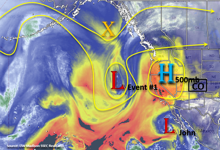
Very dry air has worked its way over the western US as the 500mb high spins over the Great Basin. Extreme temperatures associated with this high has place many areas under an Excessive Heat Warning. To start of this FTO period, we will begin with Event #1 from Monday’s FTO. Starting Friday, the ridge will begin to move eastward as the closed low over the Pacific makes its way to the west coast. This will displace the ridge to the east, and a cut-off low, from the previous trough, will place itself over TX/OK. This weekend, the ridge completely breaks down with the passing of the trough to the north, and the cut-off low moves west and north into eastern Colorado where it slowly migrates east through Tuesday. This should keep the chances for rainfall over eastern Colorado minimal due to northeastly flow aloft. Tropical cyclone John will also move north this weekend, but shouldn’t affect the region until early next week by possibly bringing in some extra subtropical moisture. Slight eastward movement of the ridge Friday to Sunday may increase the chances for afternoon rainfall over the San Juan and Central Mountains. Widespread flooding is not anticipated though burn scars may be prone to flash flooding and mud flows.
From Tuesday to Thursday, a weak ridge begins to rebuild over the Pacific Northwest. Slight movements of the center of the 500mb high indicate there will be a chance of showers over eastern Colorado with returned low-level moisture to start Event #2. Tropical Cyclone John is absorbed into the westerlies as well, which has the potential to pull in a little extra moisture. An incoming trough over the Pacific Northwest pushes the ridge far enough east on Friday and Saturday that subtropical moisture is expected to return both east and west over Colorado. Showers will become more widespread, and at this time, there is an Elevated flood threat to start next weekend though there is still low confidence in a forecast this far out.
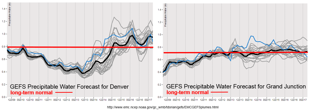
Precipitable Water (PW) continues to remain below average over western Colorado. A small increase is seen going into this weekend thanks to the slight eastward movement of the ridge. The GEFS continues to hold average PW over the next week, which will allow afternoon showers and thunderstorm to return to the San Juan and Central Mountains. For Event #2, the moisture should be far enough north to return afternoon rainfall chances to the Northern Mountains as well. Eastern Colorado remains quiet heading into this weekend though there is a chance for isolated showers over the mountains with residual moisture under the ridge. By mid-week the subtropical moisture begins to recover with PW returning to above average values. Quite a bit of uncertainty this far out, but the subtropical moisture trend is upwards, so there is the possibility of heavy rainfall returning to the forecast.
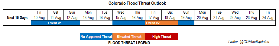
Below we describe the two identified precipitation event of this FTO in more detail.
Event #1: Friday (8/10) – Sunday (8/12)
No Apparent Threat as rainfall returns to western Colorado.
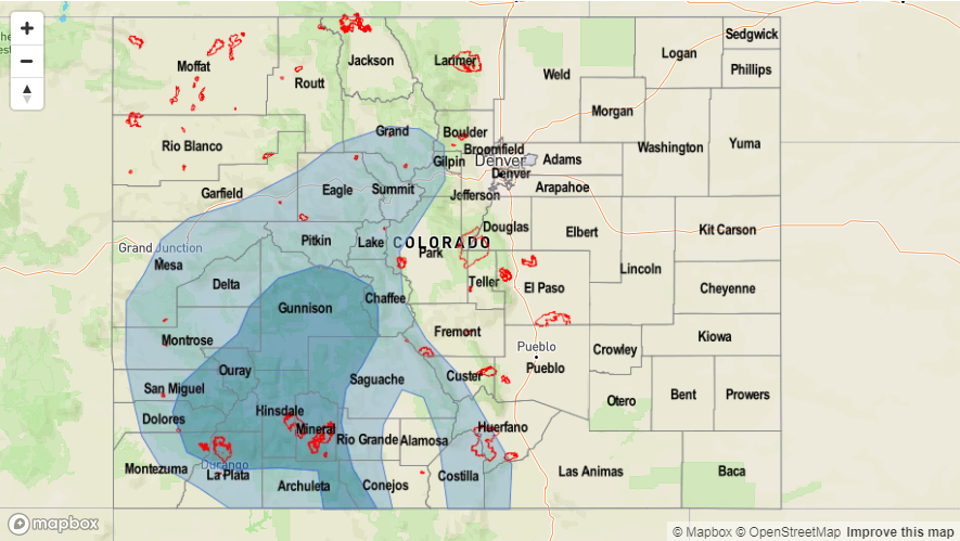
Slight shift in the upper-level ridge axis is expected to return some more low-level moisture to the southwest corner of the state. Widespread rainfall is not anticipated, but afternoon showers over the Central and San Juan Mountains are expected to increase. There is still a question as to how much subtropical moisture will return, though a flood threat will likely be unnecessary. Rain rates may exceed the 0.5 inch/hour threshold, which could cause issues with burn scars. Please tune into the daily FTB as those details will evolve day to day. Possible threats include mud flows, debris slides and flash flooding should a storm track directly over a recent burn scar. To the east, northeasterly flow associated with the cut-off low should prevent chances for afternoon showers and thunderstorms. A few storms may be possible along the Continental Divide and far southern Southeast Mountains.

Event #2: Wednesday (8/15) – Sunday (8/19)
Elevated / No Apparent Threat as subtropical moisture returns with the ridge axis shifting eastward.
Event #2 of this FTO still has a lot of details that are in the works. The GFS continues to shift the upper-level ridge to the east, which would allow subtropical to return to the state both east and west of the Divide. GEFS moisture plumes indicate there is an upward trend in PW throughout the week, which would return the heavy rainfall chances. Tropical Cyclone John may also increase moisture into the area starting on Tuesday as it is absorbed into the next passing system. If this forecast continues to stay on track, the Event looks to return showers and thunderstorms chances to Northern Mountains. Trends in future model runs will be monitored closely throughout this weekend, and new details will be incorporated into Monday’s FTO.