Issue Date: Thursday, August 9th, 2018
Issue Time: 09:20 AM MDT
Summary:
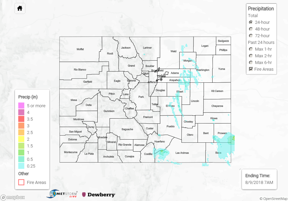
Interesting start to Wednesday morning with thunderstorms well under way over the Northeast Plains from the prior night. These storms worked their way south through the morning/afternoon and produced some severe hail (1.25 inches) and gusty winds. Even a rare morning tornado was reported at 6:30am in Weld County. There was quite a bit of convection on the west side of this disturbance. A gust front from the storm pushed up against the Front Range and brought fog to the Urban Corridor by mid-morning. This pretty much killed all the chances for convection in the afternoon hours. With dew points in the 60Fs, this system was able to drop some heavy rainfall as it quickly progressed south. Max 1-hour rain rates just under 1 inch were estimated from radar. A CoCoRaHS station near Woodrow reported 0.97 inch of rain from the thunderstorm complex.
During the afternoon, more isolated thunderstorms popped up over the southern Southeast Mountains. Two flash flood warnings were issued for the Spring Creek burn scar, but thankfully no flooding was reported. Radar estimated this area received up to 1.5 inches of rainfall, but this total did not fall over the burn scar itself. Convection ended around 6PM with some light showers over the higher terrains through early morning.
To see how much precipitation fell over your area, scroll down to the State Precipitation Map below.
Click Here For Map Overview