Issue Date: Wednesday, August 8th, 2018
Issue Time: 09:45 AM MDT
Summary:
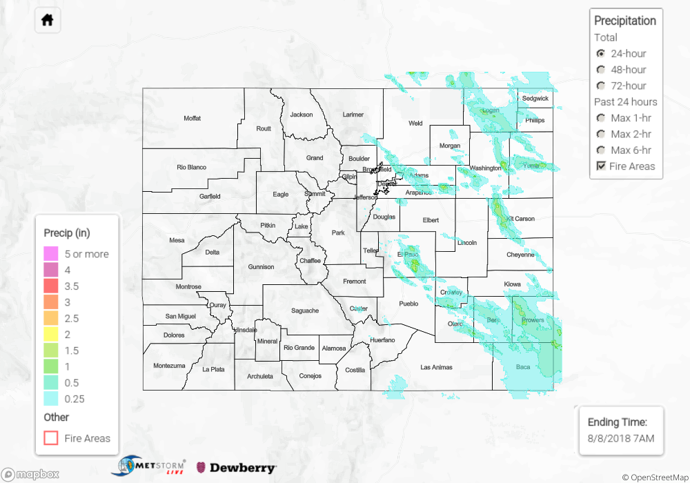
Another active day on Tuesday with a second round of severe thunderstorms occurring over eastern Colorado. Decent shear and high instability set the stage for another day of strong storms. Thunderstorms on Tuesday were less severe and widespread than Monday, but they still produced some impressive heavy rainfall, strong winds and large hail. Storms first began to fire over the southern mountains by mid-afternoon and then further north during the evening hours. A passing shortwave helped keep storms thriving over the eastern plains during overnight hours and into this morning.
Similar to Monday, there were several severe thunderstorm warnings and even a tornado warning for Weld County near Keota this morning. A brief touchdown was reported in a field with no damage occurring. Storms yesterday were again big hail producers with hail up to 2 inches in diameter occurring under the strongest storm cores. Outflow boundaries from these storms help kick off more thunderstorm action, and a gust of 57 mph was measured at a mesonet station in Strasburg. As far as rainfall, storms yesterday produced 1-hour rain rates just over 1.5 inches. A storm in El Paso County produced 2 inches of rainfall according to radar estimates, which was the largest rain producer of the day. There were a couple of areal flood advisories, though flooding was not reported. Most storms did not track over the same areas that received heavy rainfall on Monday. The Purgatoire river gage at Las Animas is currently in Action stage, but it is not expected to reach Minor flooding.
To see how much precipitation fell over your neighborhood, scroll down to the State Precipitation Map below.
Click Here For Map Overview