Issue Date: Wednesday, August 1st, 2018
Issue Time: 08:55AM MDT
— Flooding is NOT expected today
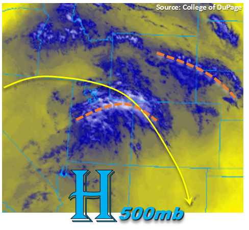
The upper-level high begins to shift a bit to the east and south today, which will shift the axis of the ridge eastward as well. This will allow some upper-level disturbances (marked in orange below) to move through the state and help increase the coverage of showers and thunderstorms this afternoon by increasing lift. Currently, the shortwave over Utah is helping produce some cloud cover over the northwest corner of the state. At this time there no observations of rainfall making it to the surface, so just a cool start to the day with temperatures in the 50Fs to low 60sF.
Precipitable Water (PW) at Grand Junction this morning was measured at 0.56 inches, so there has been a slight increase since yesterday though it is still well below normal for this time of year. With the early passing of the shortwave over the northwest corner, rather than at peak heating, showers and thunderstorms over the Central and Northern Mountains will likely be confined to the Divide this afternoon. Further south over the San Juan Mountains, showers and thunderstorms should have a bit better coverage this afternoon. However, the large dew point/temperature spread will produce more gusty winds than plentiful rainfall.
East of the Divide, the shortwave should be arriving just as thunderstorms are starting to pop over the higher terrains with the diurnal flow. This should help increase coverage of storms along the Front Range, Palmer Ridge and Southeast Mountains. The sounding this morning measured PW at 0.64 inches, which again is an increase from yesterday, but still not quite high enough to produce local, heavy rainfall. Storm motion will be to the SSE at around 15-20 mph, so this too, will limit heavy rainfall chances. To the east of the I-25 corridor over the Palmer Ridge and Southeast Plains, SE flow at the surface will pull in some higher dew points from the plains, so expecting rain rate intensities to increase a bit for storms that track into this area. However, rain rates are still expected to be below flood threat criteria, so flooding is not expect today. The main threats from the storms today will be dangerous lightning and gusty outflow winds. Hail is also possible under the stronger storms over the eastern plains.
Today’s Flood Threat Map
For more information on today’s flood threat, see the map below. For Zone-Specific forecasts, scroll below the map.
Zone-Specific Forecasts:
Raton Ridge, Southeast Mountains, Southeast Plains, Northeast Plains, Front Range, Urban Corridor, Palmer Ridge:
Mostly clear skies this morning will help increase instability as the sun begins to shine. By mid-afternoon the shortwave will arrive at peak heating, which is expected to increase coverage of thunderstorms over the higher terrains. As storms move off the mountains into the adjacent plains, lack of low-level moisture will have storms producing more gusty winds than heavy rainfall. As the storms track east of the I-25 corridor into the Palmer Ridge and Southeast Plains, rain rates are expected to increase some due to higher low-level moisture. The rain rates should remain below flood threat criteria, so flooding is not expected. Max 1-hour rain rates are as follows:
Front Range, Southeast Mountains, Urban Corridor, Northeast Plains: 0.25-0.6 inches/hour
Palmer Ridge, Raton Ridge, Southeast Plains: 0.75 – 1.0 inch/hour
Primetime: 1:30PM to 11PM
Southwest Slope, San Juan Mountains, San Luis Valley, Grand Valley, Northern Mountains, Northwest Slope, Central Mountains:
Cloudy start to the day for the northwest corner of the state. The early arrival of the shortwave, should keep measurable rainfall confined to the Divide this afternoon over the Northern and Central Mountains. Max 1-hour rain rates are expected to be under 0.15 inches with plentiful virga and light showers. Further south, thunderstorms should be confined to the southern ridgelines of the San Juan Mountains. Max 1-hour rain rates up to 0.3 inches/hour are possible. Once again, the HRRR shows a lot of near surface smoke over these regions, so expect limited visibility. Flooding is not expected today.
Primetime: 2PM to 6PM