Issue Date: Tuesday, July 31st, 2018
Issue Time: 08:00AM MDT
— Flooding is NOT expected today
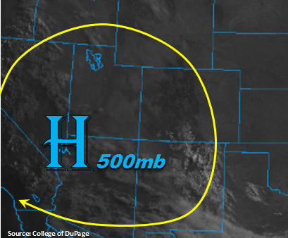
Other than a few clouds over the Southeast and San Juan Mountains, the visible satellite imagery below shows clear skies this morning. The drying trend will continue today as northerly upper-level flow pulls in a very arid air mass from the north. Precipitable Water (PW) values at Grand Junction and Denver this morning have dropped to 0.5 inches and 0.46 inches, respectively. Normal for this time of year is closer to 0.8 inches. Thus, the dry atmosphere and rising pressure should eliminate the rainfall threat this afternoon over the higher terrains. Some residual moisture may be able to hold on over southern Colorado near the NM border, so the Southeast and San Juan Mountains may receive some light, high-based afternoon showers. Rain totals are expected to be under 0.15 inches. Flooding is not expected today.
Today’s Flood Threat Map
For more information on today’s flood threat, see the map below. For Zone-Specific forecasts, scroll below the map.
Zone-Specific Forecasts:
Raton Ridge, Southeast Mountains, Southeast Plains, Northeast Plains, Front Range, Urban Corridor, Palmer Ridge:
Mostly clear this morning with the exception of a few high clouds over the Southeast Mountains. Some isolated showers may be possible over the Southeast Mountains this afternoon, but max 1-hour rain rates will remain below 0.15 inches. Elsewhere, expect some cloud cover over the higher terrains this afternoon with more seasonal to a bit below average high temperatures. Flooding is not expected today.
Primetime: 2PM to 6PM
Southwest Slope, San Juan Mountains, San Luis Valley, Grand Valley, Northern Mountains, Northwest Slope, Central Mountains:
Abundant sunshine today with some scattered cloud cover over the higher terrains this afternoon. A few high based showers may be possible over the southern San Juan Mountains. Max 1-hr rain rates should remain under 0.15 inches. High temperatures in the lower valleys will be in the 90sF with higher elevations in the 70-80F range. The HRRR shows some near surface smoke over these regions through this evening, so expect limited visibility. Flooding is not expected today.
Primetime: 1PM to 6PM