Issue Date: Sunday, July 29th, 2018
Issue Time: 9:30 AM MDT
Summary:
Yesterday was another wild day of weather for Colorado, with flash flooding, hail, tornadoes, heavy rain, and strong winds peppering the state. The upper-level high positioned to our southwest has been relentless in ushering mid-level moisture our direction, while low-level easterly flow enhances wind shear and moisture for areas east of the Divide. The result for Saturday was plenty of strong-to-severe storms, with the most intense reports summarized below:
Flash Flood: 2 miles N of El Jebel (Eagle County), Wray (Yuma County), 1 mile N of Wray (Yuma County)
2.75 inch diameter hail: 1 mile SE of Julesburg (Sedgwick County), 4 miles N of Logan Corners (Logan County), 6 miles NE of Amherst (Phillips County)
2.5 inch hail: 12 miles SE of Julesburg (Sedgwick County), 5 miles NE of Amherst (Phillips County)
Tornado: 7 miles W of Sterling (Logan County)
77 mph Thunderstorm Wind Gust: 1 mile SE of Julesburg (Sedgwick County)
63 mph Thunderstorm Wind Gust: 3 miles W of Sterling (Logan County)
60 mph Thunderstorm Wind Gust: 10 miles ESE of Whitewater (Mesa County)
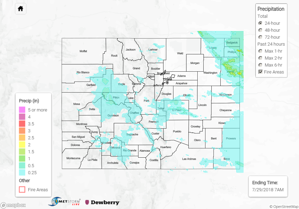
For a look at precipitation estimates in your area, please see our State Precipitation Map below.
Click Here For Map Overview
Note: We have identified a possible underestimation in QPE over the southwest part of the state. We are working to on this issue, and will provide an update as soon as possible.