Issue Date: Saturday, July 28th, 2018
Issue Time: 9:30 AM MDT
Summary:
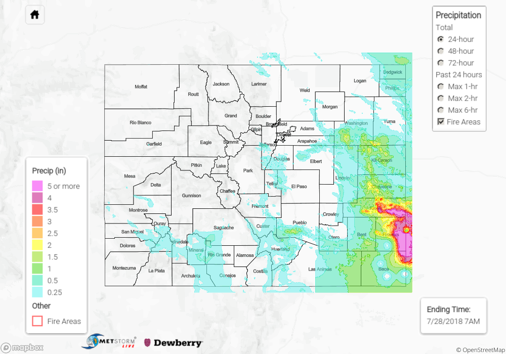
The atmosphere was primed yesterday to produce a myriad of weather impacts across Colorado, and it succeeded in fulfilling that potential. Heavy rain, burn scar flash flooding/debris flow, hail up to 3 inches in diameter, wind gusts up to 70 mph, and a few tornadoes were the impacts that Mother Nature threw at the state. As far as flooding flooding goes, in La Plata County, a mud flow was reported in the vicinity of County Road 203 and Tripp Gulch, and in Custer County, flash flooding caused washouts on County Road 387. Some of the more severe hail, wind, and tornado reports are as follows:
68 mph wind gust: 11 miles ESE of Thurman (Kit Carson County)
67 mph wind gust: 1 mile E of Kit Carson (Cheyenne County)
57 mph wind gust: 3 miles SW of Leader (Adams County)
3 inch hail: 5 miles E of Flagler (Kit Carson County)
1.75 inch hail: 3 miles NNE of Wellington Lake (Jefferson County)
1.25 inch hail: 7 miles NE of Ponderosa Park (Elbert County)
Tornado: 7 miles S of Byers (Arapahoe County), 2 miles NE of Ponderosa Park (Elbert County), 11 miles SSE of Leader (Adams County)
For a look at precipitation estimates in your area, please see our State Precipitation Map below.
Click Here For Map Overview
Note: We have identified a possible underestimation in QPE over the southwest part of the state. We are working to on this issue, and will provide an update as soon as possible.