Issue Date: Friday, July 27th, 2018
Issue Time: 9:30 AM MDT
Summary:
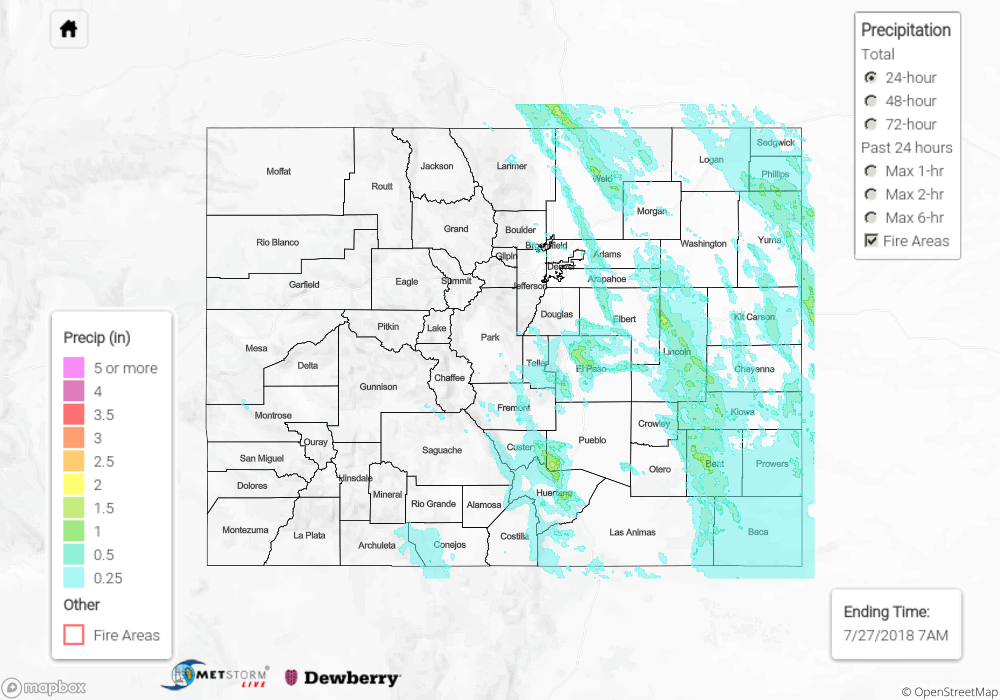
Moisture remained plentiful east of the Continental Divide yesterday, providing the fuel for another period of scattered showers/thunderstorms producing periods of heavy rainfall; the stronger storms also produced hail (0.25-1.0” in diameter) and wind gusts up to 50-80 mph. With the heavy rainfall came more flash flooding issues, with the following observations being reported to the National Weather Service:
4 miles WSW of Falcon (El Paso County): 10 inches of water over the road at Stetson Hills and Chanhassen.
4 miles W of Falcon (El Paso County): Water up to headlights of cars at Dublin and Mustang Rim. Stalled cars on the road.
4 miles NNE of Peterson AFB (El Paso County): Roadway closed due to flooding at Carefree and Marksheffel.
1 mile ENE of Wray (Yuma County): Street flooding in Wray.
9 miles SSW of Wetmore (Custer County): Highway 165 in Custer County closed due to flooding.
West of the Divide, moisture ticked down as compared to previous days. As a a result, thunderstorm coverage was more isolated-to-widely scattered, with the majority of activity confined, and adjacent, to higher terrain south of I-70. Showers/thunderstorms were garden-variety, producing mainly light-to-moderate rainfall. For a look at precipitation estimates in your area, please see our State Precipitation Map below.
Click Here For Map Overview
Note: We have identified a possible underestimation in QPE over the southwest part of the state. We are working to on this issue, and will provide an update as soon as possible.