Issue Date: 7/19/2018
Issue Time: 9:55 AM

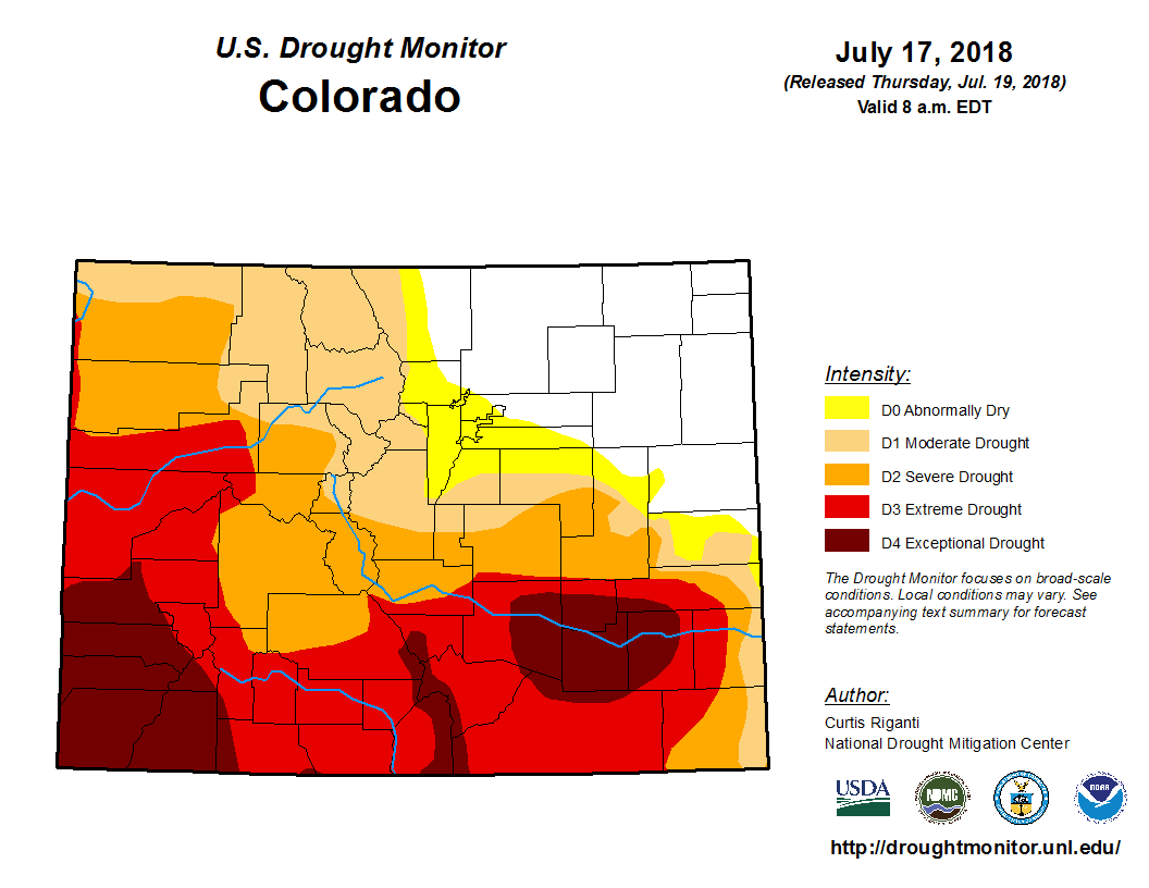
To start off today’s edition of the FTO, let’s take a quick look at the most recent drought monitor, released this morning at 6 AM MDT. Nearly 77% of the state is in moderate drought or worse, with just over 13% of the state under Exceptional Drought conditions. Northeast Colorado continues to avoid drought conditions, reaping the benefits of the spring/early summer storm track.
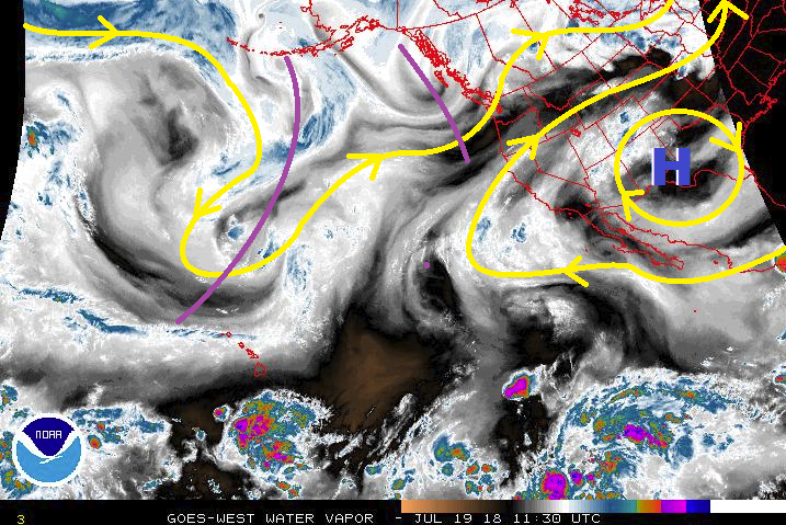
Looking forward to the next 15 days, the first half of the period looks to be the wettest, with the majority of the activity occurring during the first four days, designated Event #1 (Friday, July 20th – Monday, July 23rd). Event #1 is a combination of monsoonal moisture, disturbances aloft (purple lines in water vapor image), a weak cool front, and easterly upslope flow behind the front. Precipitation chances begin to increase on Friday, mainly over/near the High Country, as monsoonal moisture works in from the southwest thanks to the shift of the upper-level high over the southern Great Plains. Through the weekend, precipitation chances will increase across the plains, as well, as monsoonal moisture spreads over the area on Saturday, with a cool front pushing southward through eastern Colorado on Sunday. Surface convergence along the front, as well as the transport of low-level moisture from the Great Plains, will increase the threat of heavy rain and organized thunderstorm activity. Monday looks to be the wettest day of the event, as monsoonal moisture, a disturbance aloft, and upslope flow behind the front all combine to bring the threat of heavy rain to much of Colorado. Precipitable water values will be near 1 inch in lower mountain valleys, and over 1 inch everywhere east of the mountains. This is plenty of moisture for efficient precipitation production, thus Monday is expected to be the most widespread flood threat day of Event #1.
The upper-level high will shift back westward, becoming centered over the Great Basin by late Tuesday, allowing drier air to work back into Colorado for Tuesday/Wednesday (July 24th/25th). Even so, enough residual moisture will be hanging around for a few scattered showers/garden-variety thunderstorms over the higher terrain during this two-day period. Event #2 begins on Thursday, July 26th, continuing through Saturday, July 28th, in the form of multiple disturbances working across eastern Colorado. This will send another weak cool front or two surging through the eastern plains, with upslope flow behind the front transporting moisture back into the foothills. There are some discrepancies on the eventual evolution of this event, as well as the amount of moisture that will return, so no flood threat designation is warranted at this time.
After Event #2, Colorado will likely dry out for the remainder of the period, with potentially a third event coming to fruition to begin August. This is a plausible scenario, given the start of monsoon season is nearly upon us, but significant uncertainty precludes the issuance of an event designation. Instead, consider this mention as something for which to be on the lookout, and an update will be provided in Monday’s edition of the FTO.
Event #1: Friday (07-20-2018) through Monday (07-23-2016)
Elevated Flood Threat as Monsoonal Moisture Combines with Other Factors
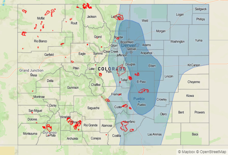
Event #1 is a combination of monsoonal moisture, disturbances aloft, a weak surface cool front, and easterly upslope flow. The majority of the state will get in on the rainfall, with the wettest day of the event being Monday. Precipitable water values will increase through the event, topping out at over an inch across eastern Colorado, with values near 1 inch over the High Country. This will lead to efficient rainfall production, especially Sunday/Monday. It will be important to monitor burn scars, especially sensitive ones like the 416, Spring, Burro, and other recent/ongoing burns, as well as urban areas and steep terrain.
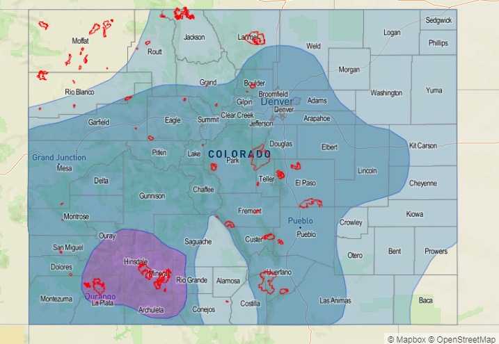

Event #2: Thursday (07-26-2018) through Saturday (07-28-2018)
No Apparent Threat due to Questions Regarding Moisture Return
Multiple disturbances aloft and another cool front surging southward through eastern Colorado are the main culprits behind Event #2. This event will be mainly for areas east of the Continental Divide, with more garden-variety showers/thunderstorms west of the Divide. Moisture return is a question mark at this time, so no flood threat designation will be assigned. The Urban Corridor, Front Range, Southeast Mountains, Palmer Ridge, and western portions of the Northeast Plains and Southeast Plains will be the focus areas for thunderstorms capable of heavy rainfall.