Issue Date: Sunday, July 15th, 2018
Issue Time: 9:30 AM MDT
Summary:
Mid-level high pressure began the day centered over southwestern Colorado, and finished the day more-or-less centered over central Colorado. This slight shift to the east allowed for monsoonal moisture to set up over the western third of the state, producing scattered showers/thunderstorms over the Southwest Slope, Grand Valley, Northwest Slope, and western portions of the Northern Mountains, Central Mountains, and San Juan Mountains. Stronger storms produced periods of heavy rainfall, and thankfully the heaviest rain fell west of the 416 Fire and Burro Fire burn scars. A few showers continue this morning across the higher terrain of the Grand Valley and Southwest Slope regions.
To the east, drier air and more subsidence aloft was in charge, suppressing all but a few isolated thunderstorms over the Front Range, Southeast Mountains, Palmer Ridge, Raton Ridge, and western portions of the Southeast Plains. This activity diminished quickly after sunset, with the final showers ending around 9:30 PM. The strongest storm of the day for these regions occurred over the southern Urban Corridor, where 0.96 inches/30 minutes was reported 6 miles W of Falcon (El Paso County).
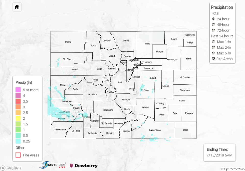
No flash flooding was reported yesterday. For a look at precipitation estimates in your area, please see our State Precipitation Map below.
Click Here For Map Overview
The map below shows radar-estimated, rainfall gage-adjusted Quantitative Precipitation Estimates (QPE) across Colorado. The map is updated daily during the operational season (May 1 – Sep 30) by 11AM. The following six layers are currently available: 24-hour, 48-hour and 72-hour total precipitation, as well as maximum 1-hour, 2-hour and 6-hour precipitation over the past 24 hour period (to estimate where flash flooding may have occurred). The 24-hour, 48-hour and 72-hour total precipitation contain bias corrections that are not disaggregated into the hourly estimates, so there will likely be some differences. The accumulation ending time is 6AM of the date shown in the bottom right corner. Also shown optionally are fire burn areas (post 2012), which are updated throughout the season to include new burn areas. The home button in the top left corner resets the map to the original zoom.