Issue Date: Friday, July 13, 2018
Issue Time: 09:25 AM MDT
Summary:
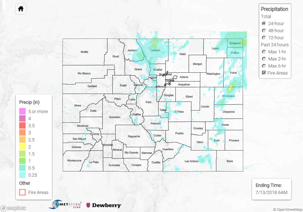
Low-level moisture increased quite a bit across the state yesterday with the upper ridge to the east. This helped provided thunderstorms with greater rainfall intensity and coverage. The surface low over eastern Colorado also brought the thunderstorm threat back to the eastern portion of the state including the plains by pulling in moisture from the east. By noon, storms began to fire over the higher terrains with the best coverage over the Northern Mountains, and Palmer Ridge/Front Range region. A secondary set of storms set up along a convergence boundary over the eastern plains. Outflow boundaries from the storms to the west help increase the activity along the boundary by early evening. Over Kit Carson County, 2.5 inches of rain fell as the boundary was nearly stationary for a couple of hours. A CoCoRaHS station in the area recorded 2.10 inches of rain. A downburst was reported over Logan County that uprooted numerous power poles with winds estimated between 80 and 90 mph. A brief tornado was also reported near Pueblo West, but no damage was reported.
Over the mountains, the main receiver of rainfall was the Northern Mountains. Over Larimer County, 2 inches of rain fell according to radar estimates. The San Juan Mountains didn’t quite reach the moisture levels as predicted, but still got a decent wetting. Near Vallecito Dam, 0.77 inches of rain was reported and 0.64 inches of rain fell 10mi SE of Pagosa Springs over a 30 minute span. One areal flood advisory was issued at 3PM for Ouray, but other than mild field ponding, no flooding was reported on Thursday.
To see how much precipitation fell in your area, scroll down to the State Precipitation Map below.
Click Here For Map Overview