Issue Date: Thursday, July 5th, 2018
Issue Time: 9:30 AM MDT
Summary:
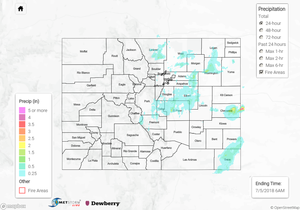
Mother Nature didn’t want to be left out of the Independence Day celebrations, so she brought her own fireworks to the party. Around lunchtime, isolated thunderstorms began to develop, first over the higher terrain along/east of the Continental Divide, and eventually over the lower elevations of eastern Colorado during the early-to-mid afternoon hours as daytime heating initiated the convection. Most storms produced plenty of virga, light rain, and gusty winds, but during the evening and nighttime hours, a few stronger, slow-moving storms worked off of increased moisture to produce periods of heavy rain over portions of the Front Range, Urban Corridor, Palmer Ridge, and Southeast Plains. Heavy rain reports from El Paso County indicate that 1- 2 inches of rain fell in the Colorado Springs area late in the evening from a batch of slow-moving thunderstorms.
From CoCoRaHS and NWS observers, here are the rainfall “winners” from yesterday:
1.96 inches: El Paso County
1.92: Cheyenne County
1.35 inches: Baca County
1.18 inches: Larimer County
1.03 inches: Washington County
No flash flooding was reported yesterday, but street/field ponding likely occurred under thunderstorms producing heavy rain. For a look at precipitation estimates in your area, please see our State Precipitation Map below.
Click Here For Map Overview
The map below shows radar-estimated, rainfall gage-adjusted Quantitative Precipitation Estimates (QPE) across Colorado. The map is updated daily during the operational season (May 1 – Sep 30) by 11AM. The following six layers are currently available: 24-hour, 48-hour and 72-hour total precipitation, as well as maximum 1-hour, 2-hour and 6-hour precipitation over the past 24 hour period (to estimate where flash flooding may have occurred). The 24-hour, 48-hour and 72-hour total precipitation contain bias corrections that are not disaggregated into the hourly estimates, so there will likely be some differences. The accumulation ending time is 6AM of the date shown in the bottom right corner. Also shown optionally are fire burn areas (post 2012), which are updated throughout the season to include new burn areas. The home button in the top left corner resets the map to the original zoom.