Issue Date: 6/28/2018
Issue Time: 7:10 AM
NO FLOOD THREAT IS FORECAST TODAY.
Strong high pressure ridging continues to reside overhead, leading to another day of hot temperatures statewide. In fact, temperatures will again nudge up a few degrees over yesterday’s readings, with record high temperatures being threatened (and likely exceeded) at a number of locations across eastern Colorado. With the dry air in place, temperatures will warm up quickly and remain hot into the evening hours, so be sure to stay hydrated and find the shade as much as possible if you must be outside today. Red Flag Warnings are in place across much of the state, as well, so be sure to check with your local NWS office for more information.
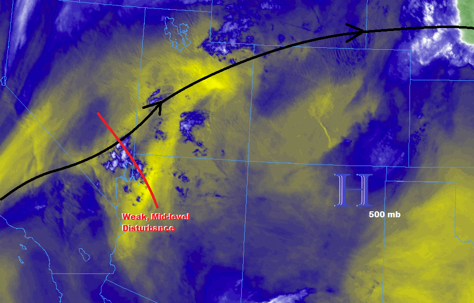
A weak mid-level disturbance (red line) embedded in the southwesterly flow aloft will pass over the state today, working alongside daytime heating to trigger a few high-based showers/thunderstorms along/east of the Continental Divide. Much like yesterday, with the high temperature-dewpoint spreads in the low-levels indicating very dry air, little (if any) rainfall will reach the surface. Instead, activity will result in mainly strong winds with plenty of virga.
Today’s Flood Threat Map
For more information on today’s flood threat, see the map below (hover over threat areas for more details). For Zone-Specific forecasts, jump below the map.


Zone-Specific Forecasts
Front Range, Southeast Mountains, Urban Corridor, Palmer Ridge, Northeast Plains, Raton Ridge, and Southeast Plains:
The heat will be the main weather story today, as high temperature records will be threatened everywhere, with a few records likely being broken. A few high-based showers/thunderstorms are expected during the afternoon and into the nighttime hours, resulting in strong winds and plenty of virga, but very little rainfall. Maximum rain rates will be less than 0.05 inches/hour over the mountains & foothills and less than 0.15 inches/hour over the plains.
Timing: Noon – 10 PM over the Front Range and Southeast Mountains, 1 PM – Midnight elsewhere, with a couple high-based showers hanging on near the CO/KS border into the early morning hours.
Northwest Slope, Northern Mountains, Central Mountains, Grand Valley, San Juan Mountains, San Luis Valley, and Southwest Slope:
Hot, dry, and breezy will be the name of the weather game across these regions today, with Red Flag Warnings in place across the entire area from Noon-8 PM. A couple high-based showers over the higher terrain of the Central Mountains, San Luis Valley, and eastern San Juan Mountains are expected during the afternoon/evening hours, resulting in little (if any) rainfall, gusty winds, and plenty of virga. Maximum rain rates will be less than 0.05 inches/hour.
Timing: Noon – 9 PM